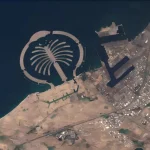
Maxar Technologies is a global leader in geospatial intelligence, providing advanced satellite imagery, AI-powered analytics, and space-based solutions. With a mission to explore, connect, and protect, Maxar enables organizations to make informed decisions using high-resolution Earth observation data. Maxar has brought together pioneers in the aerospace and geospatial industries to push the boundaries.
Maxar’s geospatial intelligence is widely used across defense, commercial, and scientific sectors. Governments rely on Maxar’s satellite imagery for national security, disaster response, and environmental monitoring. Telecommunications companies use its data for network planning, while industries such as mining and agriculture leverage Maxar’s insights for resource management and sustainability.
Products

Maxar offers a range of cutting-edge products, including Precision3D, which provides highly accurate digital twins of Earth for simulation and navigation. The Rapid Access Program allows customers to task satellites for real-time imagery acquisition, ensuring timely intelligence for critical missions. Additionally, Vivid Advanced delivers high-resolution imagery basemaps for urban planning and infrastructure development.
Maxar Spacecraft Platforms
- Maxar 1300 Series is a high-power geostationary satellite platform with modular architecture, fuel-efficient station-keeping, and advanced control systems.
- Maxar 500 Series is a scalable mid-size platform optimized for high stability, agility, and pointing accuracy, supporting multiple missions and orbits.
- Maxar 300 Series is a low Earth orbit platform built for rapid constellation deployment, featuring configurable telemetry and intersatellite link support.
These platforms ensure longevity, high performance, and adaptability for various space-based applications.
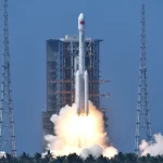
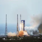
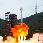
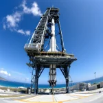
Launches
Maxar has a rich history of satellite launches, contributing to advancements in Earth observation and space exploration. Some key launches include:
- WorldView-1 (2007) – The first half-meter resolution commercial imaging satellite.
- GeoEye-1 (2008) – Provided the highest-resolution commercial Earth imagery at the time.
- WorldView-2 (2009) – Introduced eight-band multispectral imaging for enhanced analysis.
- WorldView-3 (2014) – First commercial satellite with shortwave infrared capabilities.
- WorldView-4 (2016) – Delivered industry-leading 30 cm resolution imagery.
- WorldView Legion (2020s) – A next-generation constellation designed for near real-time insights.
These launches have strengthened Maxar’s ability to provide high-resolution geospatial intelligence for defense, commercial, and scientific applications.

Partnerships and Collaborations
Maxar collaborates with industry leaders and government agencies to enhance geospatial intelligence capabilities. Its partnerships with organizations like NASA and defense agencies enable groundbreaking space missions, including the Psyche Deep Space Spacecraft and WorldView Legion, which provide next-generation Earth observation capabilities.
Maxar also collaborates with industry leaders like Esri, a global leader in GIS mapping and spatial analytics, and UP42, which integrates Maxar’s satellite tasking for real-time geospatial insights. Other notable partners include Hexagon, specializing in digital reality solutions, and Bentley Systems, known for infrastructure engineering software. These partnerships enhance Maxar’s ability to deliver advanced geospatial intelligence across various industries.

Maxar Intelligence continues to redefine geospatial intelligence, offering innovative solutions that empower decision-makers across industries. With its commitment to technological advancement and strategic partnerships, Maxar remains a key player in shaping the future of Earth observation and space-based analytics.