Tag: Satellite Cameras
-
NASA to Preview US Spacewalks at International Space Station in January
NASA astronauts will conduct a pair of spacewalks in January outside the International Space Station to prepare for the installation of a roll-out solar array and complete other tasks. Experts from NASA will preview the spacewalks in a briefing at 2 p.m. EST Tuesday, Jan. 6, at NASA’s Johnson Space Center in Houston. Participants include: Bill…
-
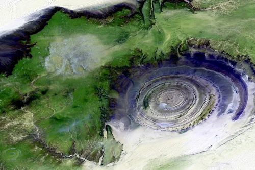
Terrabit Satellite Imagery Platform for High-Resolution Earth Observation Data
Terrabit, an Australian geospatial intelligence and data-solutions company, is highlighting the satellite imagery offerings that support government, defence, enterprise and commercial users requiring reliable Earth-observation data for analysis, planning and operational decision-making. Through the satellite imagery services, Terrabit provides customers with access to high-resolution, multi-source imagery combined with analytics workflows designed to real-world operational needs.…
-

ICEYE & Lee County Renew Partnership to Strengthen Hurricane Response Using Satellite Data
ICEYE, a global leader in satellite-powered disaster management solutions, announced that it has renewed its agreement with Lee County Emergency Management (LCEM) to continue enhancing the county’s disaster response and preparedness capabilities to provide near-real time flood and storm surge monitoring. Now entering its second year with ICEYE, this renewal builds on a successful first…
-

e-GEOS & Umbra Partner to Develop Advanced SAR-Based Geospatial Intelligence Solutions
e-GEOS, a leading provider of value-added Earth Observation services across the entire value chain part of the Leonardo Group, and Umbra, a fully-integrated American space technology company operating a high-volume and high-quality Synthetic Aperture Radar (SAR) constellation, have signed a multi-year strategic agreement to jointly develop innovative geospatial intelligence solutions for customers worldwide. The deal…
-

KONGSBERG and Helsing Collaborates to Advance European Space Capabilities
Kongsberg Defence & Aerospace, the Norwegian defence technology company, and Helsing, the German defence technology company, have signed a teaming agreement to accelerate the realisation of critical European space capabilities. The companies aim to deploy a sovereign, space-based intelligence, surveillance, and targeting (IST) constellation with an interconnected comms layer for Europe by 2029. HENSOLDT, the…
-
Colombia Adopts OroraTech Satellites for National Wildfire Monitoring
Colombia has become the first country in Latin America to strengthen its National Disaster Risk Management System through the implementation of a national wildfire detection program using satellite technology. This initiative results from a new partnership between the National Unit for Disaster Risk Management (UNGRD) and OroraTech, a global leader in wildfire intelligence, via its local…
-

Esri Partners with Amazon Web Services to Advance Generative AI in ArcGIS
Esri, the global leader in geographic information systems (GIS) and geospatial AI technology, has signed a strategic collaboration agreement (SCA) with Amazon Web Services (AWS) to advance the integration of Generative AI (GenAI) into geospatial solutions and workflows. Bringing Esri’s geospatial AI platform, ArcGIS, together with the scalable cloud infrastructure on AWS enables organizations to…
-
Open Cosmos Concludes MANTIS Mission by Redefining Earth Observation with AI and Agility
Open Cosmos, the leading space company using space data to solve global challenges, is celebrating the successful completion of its MANTIS mission – a two-year programme that delivered cutting-edge Earth Observation data and set a new benchmark for sustainable space operations. Launched on 11 November 2023 aboard SpaceX’s Transporter-9, MANTIS was the first ESA InCubed satellite,…
-

ICEYE and EMIS Partner to Enhance Slovakia’s Real-time Flood Monitoring
ICEYE, the global leader in synthetic aperture radar (SAR) satellite data, and EMIS, a provider of geospatial information systems in Slovakia, announced a strategic partnership to expand access to critical, near-real-time hazard information for Slovak authorities. Through this collaboration, ICEYE’s satellite-derived flood intelligence will be seamlessly integrated into EMIS’s GIS platform, the country’s trusted central…
-
Malin Space Science Systems: Developing Next-Generation Imaging Solutions for Space Exploration
Malin Space Science Systems (MSSS), based in San Diego, California, stands as one of the most influential names in space imaging and planetary exploration. Founded in 1990, the company has built a stellar reputation for designing and manufacturing advanced camera systems and imaging subsystems for spacecraft. Its cutting-edge technologies have played pivotal roles in NASA’s…