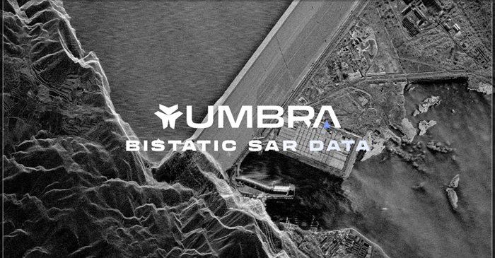
Umbra, headquartered in Santa Barbara, continues to advance commercial Synthetic Aperture Radar (SAR) imaging through a constellation designed to deliver high-resolution, all-weather, day-and-night Earth observation. Umbra’s remote sensing platform provides multiple SAR imaging modes designed to diverse mission requirements, enabling customers to select between ultra-high-resolution targeting and wide-area surveillance depending on operational needs. Operating in Low Earth Orbit (LEO), Umbra’s radar satellites are engineered to capture imagery independent of cloud cover, lighting conditions or atmospheric interference. The company integrates satellite hardware development, mission operations and data distribution into a vertically integrated model that supports government, defense and commercial geospatial intelligence applications.
Umbra provides taskable SAR imagery products that allow customers to collect data across different imaging geometries and operational scenarios. The product suite includes multiple imaging modes optimized for resolution, coverage area and revisit performance. Customers can access high-resolution radar imagery and derived products through Umbra’s data delivery platform, enabling applications such as infrastructure monitoring, maritime awareness, disaster assessment, defense intelligence and environmental analysis. The SAR technology captures detailed structural information by transmitting radar pulses and analyzing returned signals, producing images with fine spatial resolution regardless of weather conditions.
Dwell Mode: Ultra-High Resolution and Dynamic Target Monitoring
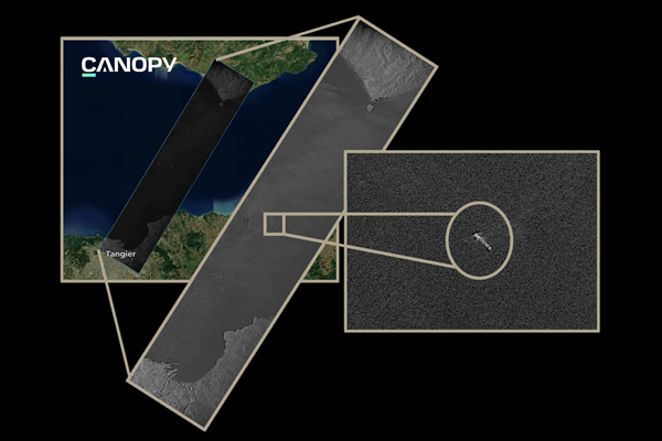
Umbra’s Dwell Mode is designed to provide enhanced detail and improved signal quality by maintaining radar focus on a specific target area for an extended observation period. By increasing coherent integration time, Dwell mode improves image clarity and allows detection of subtle changes or movements within the scene. This mode supports applications requiring high sensitivity and fine detail, such as infrastructure inspection, activity monitoring and change detection. Extended observation over a localized area enhances the ability to detect small objects and subtle motion signatures that may not be visible in conventional imaging passes.
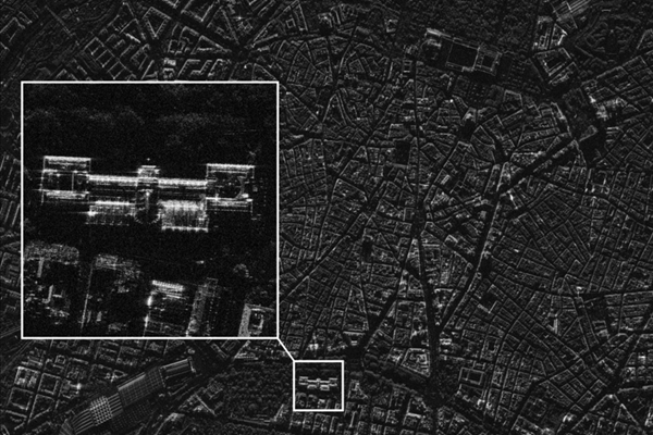
Spotlight Mode: High-Resolution Targeted Imaging
Spotlight Mode is optimized for capturing high-resolution imagery of specific areas of interest. In this mode, the radar beam remains focused on a designated target while the satellite moves along the orbital path, synthesizing a large aperture for enhanced resolution. Spotlight imaging provides detailed structural and surface information, making it suitable for urban analysis, facility monitoring, maritime tracking and strategic intelligence operations. This mode balances resolution and area coverage, delivering precise imagery while maintaining operational efficiency.
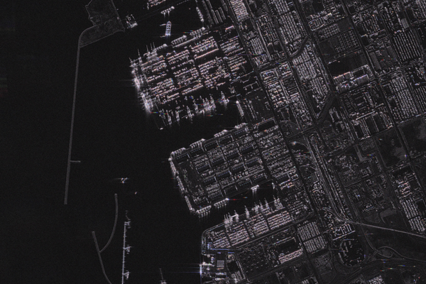
Scan Mode: Wide-Area Surveillance Coverage
Umbra’s Scan Mode is engineered to capture broader geographic areas in a single pass and providing wide-area situational awareness. This mode sacrifices some spatial resolution in exchange for expanded coverage, making it suitable for regional monitoring, disaster response, and large-scale environmental analysis. Scan mode enables customers to rapidly assess extensive areas, identify emerging events and prioritize areas requiring higher-resolution follow-up imaging. It supports efficient surveillance over large maritime zones, border regions or disaster-affected territories.
Open Data Initiative
Through the Open Data initiative, Umbra provides selected SAR datasets to support research, innovation and public engagement. The open data program allows academic institutions, developers and analysts to access radar imagery for experimentation and application development. By sharing representative SAR data, Umbra promotes broader understanding of radar remote sensing and encourages development of analytics tools that leverage SAR’s unique capability to capture structural information under all weather and lighting conditions.
Umbra’s multi-mode SAR imaging architecture allows customers to design data collection strategies based on mission objectives whether requiring ultra-high resolution targeting, detailed monitoring of specific sites or wide-area reconnaissance. The ability to operate continuously in cloud-covered, nighttime or adverse weather environments enhances operational reliability across global locations. Through a constellation-based approach and flexible imaging modes, Umbra continues to support defense, commercial and humanitarian missions with persistent radar-based Earth observation capabilities.
About Umbra
Umbra is a US-based space technology company specializing in commercial Synthetic Aperture Radar (SAR) satellite systems and geospatial intelligence solutions. Headquartered in Santa Barbara, California, USA, Umbra designs, builds and operates a constellation of high-resolution radar imaging satellites that provide persistent Earth observation capabilities. Umbra’s SAR satellites are capable of capturing imagery regardless of weather conditions, cloud cover or time of day. By operating in Low Earth Orbit (LEO), the constellation delivers high-frequency revisit rates and fine-resolution radar data suitable for defense, intelligence, maritime monitoring, disaster response and commercial analytics applications. In addition to satellite operations, Umbra provides data products and analytics services that enable customers to access radar imagery and derived insights through secure platforms. The company integrates satellite hardware development, mission operations and data delivery under a vertically integrated model to support government and commercial geospatial intelligence requirements.