The aerospace measurement and control system consists of a ground-based measurement and control network and a space-based measurement and control network, which are responsible for “upload and download” communication functions such as orbit measurement, telemetry reception, data transmission, and command uploading.
1. Ground measurement and control network
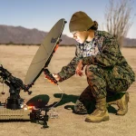
The ground-based measurement and control network mainly uses radio measurement and control technology as the main method, supplemented by optical measurement and control systems, and follows the frequency band rules allocated by the International Radio Union (ITU). Our country has established a measurement and control system based on the C/S-band ground-based network. The C-band measurement and control network (uplink 5850-6425 MHz, downlink 3625-4200 MHz) and S-band measurement and control network (uplink 2025-2120 MHz, downlink 2200-2300 MHz) complete space operation services. With the deepening of deep space exploration missions, the global X-band and Ka-band measurement and control networks are gradually advancing and integrating with international networking to further expand measurement and control capabilities. Medium and low orbit spacecraft mainly use the S-band microwave unified system (USB) with wide-band, multi-channel, and multi-modulation characteristics. The USB system mainly relies on domestic ground stations, with a longitude span of about 75°E-125°E and a latitude span of 20°N-50°N. Onshore movable stations and maritime aerospace measurement ships are flexibly distributed in a certain area and have strong maneuverability. The geosynchronous orbit spacecraft mainly uses the C-band microwave unified system (UCB), which has multi-task management capabilities and is connected to the international CCSDS standard. UCB system measurement and control stations are distributed in the mid- and low-latitude areas of central and eastern my country. They consist of land stations and measurement ships forming a geosynchronous orbit satellite measurement and control network. Among my country’s ground-based measurement and control networks, the C-band measurement and control network consists of the Xi’an Satellite Measurement and Control Center, full-function fixed stations, ship-borne stations, several limited stations and telemetry single-receiver stations; the S-band measurement and control network includes two aerospace command and control centers, the Beijing Aerospace Command and Control Center and the Xi’an Satellite Measurement and Control Center, domestic fixed stations, movable stations and the Yuanwang survey ship, overseas sites and international networking systems. The mission targets include the launch, transfer and long-term on-orbit management of geostationary orbit satellites, manned spaceflight, medium and low orbit satellites, etc.
2. Space-based measurement and control network
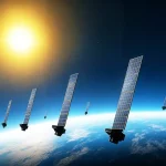
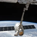
With the increase in requirements such as launch frequency, measurement arc segment and response speed of space missions, ground-based measurement and control networks can no longer fully meet the needs of measurement and control missions. In order to solve the pain points of low distribution coverage of my country’s regional ground measurement and control network and limited ground measurement and control accuracy for long-distance missions such as deep space exploration, my country has developed a space-based measurement and control network based on the ground-based measurement and control network. The space-based measurement and control network uses satellite platforms in space to track and measure, telemetry, remote control and communicate with spacecraft. It realizes data transfer between spacecraft and ground stations through relay satellites. The working frequency of space-based inter-satellite links is concentrated in the Ka band. In 2008, my country successfully launched a relay satellite for the first time and put it into use, which greatly improved the measurement and control communication coverage and information transmission capabilities. At present, our country has built a space-based measurement and control constellation composed of multiple “Skylink” series relay satellites. These satellites operate in geostationary orbit (GEO) and serve as data relay platforms to achieve high-coverage measurement and control support for low-orbit spacecraft.
(1) Tianlian No.1
Tianlian-1 includes Tianlian-1 01 star, Tianlian-1 02 star, Tianlian-1 03 star, Tianlian-1 04 star, and Tianlian-1 05 star. From 2011 to 2012, the Tianlian-1 satellite system completed the Samsung global network, making my country the second country after the United States to have an independent and controllable space-based relay system. In 2016, Tianlian-1 01 was replaced by Tianlian-1 04.
(2) Tianlian No. 2
Tianlian-2 includes Tianlian-2 star 01, Tianlian-2 star 02, Tianlian-2 star 03, Tianlian-2 star 04, and Tianlian-2 star 05. On March 27, 2025, the Tianlian-2 04 satellite was successfully launched, and Ka-band emergency measurement and control products were applied for the first time, greatly enhancing the safety of satellite measurement and control. On April 28, 2025, the Tianlian-2 05 satellite was successfully launched. It is equipped with a phased array antenna (can serve 8 spacecraft in parallel), quantum key distribution technology, etc., and the system coverage and tracking duration have been further improved.
3. Maritime measurement and control force
(1) Yuanwang-3 survey ship
Yuanwang-3 is approximately 180 m long, 22.2 m wide, and has a maximum height of 37.8 m. When fully loaded, Yuanwang-3 has a displacement of 17,000 t, a draft of 8 m, and a cruising speed of nearly 20 knots (approximately 36 km/h). Under normal circumstances, it can sail continuously for 100 days at a time and has an endurance of 18,000 nautical miles. It can perform tasks in designated sea areas of the Pacific, Atlantic and Indian Oceans.
(2) Yuanwang-5 survey ship
The Yuanwang-5 survey ship is my country’s third-generation aerospace survey ship. It consists of two parts: a general ship platform and aerospace measurement and control equipment. It is divided into four systems: shipbuilding, measurement and control, communications, and meteorology. The Yuanwang-5 survey ship has a full load displacement of 25,000 tons, a wind resistance of up to level 12 and above, and can sail in any sea area within 60 degrees north and south latitude.
(3) Yuanwang-6 survey ship
The Yuanwang-6 survey ship is my country’s second third-generation aerospace ocean survey ship. It has a full load displacement of 25,000 tons, a wind resistance of up to level 12 and above, and can sail in any sea area within 60 degrees north and south latitude. Multiple sets of large-scale measurement and control equipment are installed on the deck of the Yuanwang-6 survey ship at the same time, which can complete maritime tracking, measurement and control tasks for various types of spacecraft such as rockets, satellites, and spacecrafts.
(4) Yuanwang-7 survey ship
Yuanwang 7 is 224.9 meters long, 27.2 meters wide, and 44.2 meters high. It has a full load displacement of nearly 30,000 tons. It can withstand Category 12 typhoons, is self-sufficient for 100 days, and can perform tasks in the Pacific, Indian Ocean, and Atlantic Oceans within 60 degrees north and south latitudes.