
Tag: Image Registration
-
Why Don’t Satellite Images Line Up with Your GIS Data?
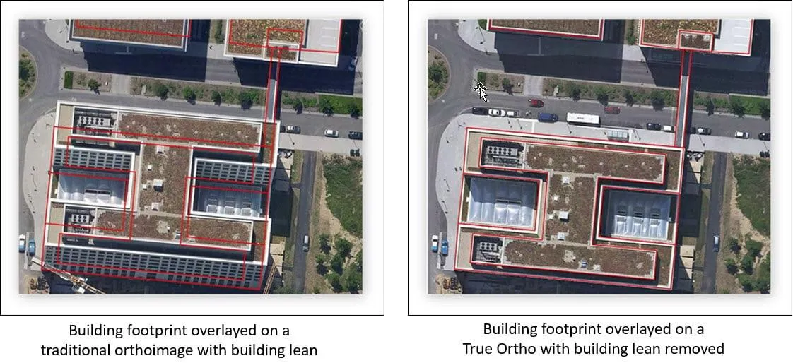
A new satellite image arrives, but roads sit slightly beside their mapped centerlines, building roofs extend beyond existing footprints, and a utility corridor appears to have shifted. Before moving any GIS features, check how both datasets were positioned. A sharper or newer image does not automatically provide a more accurate ground reference. Misalignment can come…