BlackSky Technology, headquartered in Herndon, Virginia, continues to advance space-based intelligence capabilities through the integrated satellite constellation, artificial intelligence analytics and cloud-based data platform. By combining high-revisit Earth observation satellites with automated analytics and real-time data delivery, BlackSky provides continuous monitoring solutions designed to support government, defense and commercial decision-making. The company’s technology platform integrates space-based imaging systems with AI-driven analytics to deliver geospatial intelligence that can track global activity, detect changes and provide actionable insights across multiple industries. BlackSky’s approach focuses on delivering frequent, timely observations that allow users to monitor evolving situations with near real-time situational awareness.
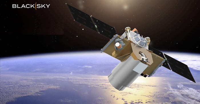
At the core of BlackSky’s technology is the constellation of small Earth observation satellites designed to capture frequent imagery of locations across the globe. The satellites operate in Low Earth Orbit (LEO), enabling rapid revisit rates that allow users to monitor dynamic events and infrastructure changes multiple times per day. This high-frequency imaging capability is particularly valuable for applications such as border monitoring, maritime tracking, disaster assessment and supply chain intelligence. By maintaining a constellation-based architecture, BlackSky ensures continuous coverage and rapid data collection from critical locations worldwide. BlackSky integrates satellite imagery with an automated geospatial intelligence platform that processes and analyzes large volumes of Earth observation data. The system combines satellite imagery with artificial intelligence and machine learning models to identify patterns, detect changes and extract insights from collected data. This automated analytics capability allows users to quickly interpret imagery and identify meaningful developments such as construction activity, infrastructure changes or logistical movements. The platform is designed to support both strategic analysis and operational decision-making across defense, security and commercial sectors.
A key component of BlackSky’s technology stack is the AI-powered change detection capability. By comparing newly acquired imagery with historical datasets, the system can identify subtle changes within monitored areas and generate alerts for potential developments. Change detection technology supports applications such as monitoring critical infrastructure, assessing environmental changes and tracking activity in strategic locations. Automated alerts allow users to focus on areas where significant changes are occurring, reducing the time required to analyze large volumes of imagery. BlackSky’s space-based intelligence system is supported by a cloud-native platform that enables rapid data delivery and seamless integration with user workflows. The platform allows customers to access satellite imagery, analytics results and geospatial datasets through secure interfaces and application programming interfaces (APIs). This cloud architecture enables organizations to integrate geospatial intelligence directly into operational systems, enabling real-time monitoring and automated decision support across enterprise and government environments.

Through the combination of satellite constellations, automated analytics and cloud-based distribution, BlackSky provides persistent monitoring capabilities that allow organizations to observe global events as they unfold. The platform enables users to track activities over time, assess trends and respond to emerging situations with improved situational awareness. The system supports a wide range of operational scenarios, including security monitoring, economic intelligence, environmental analysis, disaster response coordination and infrastructure management.

As global activities become increasingly dynamic and data-driven, the ability to monitor events from space with high frequency and automated analysis becomes essential. BlackSky’s technology architecture addresses this requirement by integrating satellite imaging, AI analytics and scalable cloud infrastructure into a unified intelligence platform. This combination enables users to access timely geospatial insights and maintain continuous awareness of developments occurring across the world.
About BlackSky Technology
BlackSky Technology is a US-based provider of real-time geospatial intelligence and satellite imagery services. Headquartered in Herndon, Virginia, USA, BlackSky operates a constellation of small Earth observation satellites designed to deliver high-frequency monitoring and rapid imaging of locations around the world. The company integrates satellite imagery with data analytics and artificial intelligence to provide geospatial insights for government, defense, commercial and humanitarian applications. BlackSky’s platform enables users to monitor global events, track infrastructure activity, assess environmental changes and support time-sensitive decision-making through near real-time data access. By combining satellite operations, analytics software and cloud-based data delivery, BlackSky provides end-to-end geospatial intelligence solutions that support situational awareness, security monitoring, supply chain analysis and disaster response activities worldwide.