1. Communication satellites
Communication satellite: Communication satellite is a user-satellite-user two-way information transmission mode. It realizes communication between ground stations or between ground stations and spacecraft by forwarding or transmitting radio signals. It can transmit telephone calls, telegraphs, televisions, faxes and data, etc. Antennas on the ground carry phone and television signals to satellites, which process them and send them back to another ground station, allowing the signals to be transmitted to a region or even an entire continent.
1. Classified by orbit: low orbit (used for regional communications), medium orbit (used for mobile communications), high orbit (used for television signal forwarding).
2. Classified by communication scope: regional communication, domestic communication, and international communication.
3. Classified by communication business types: fixed communications, mobile communications, television broadcasting, maritime communications, tracking and data relay.
Communication satellites are the earliest type of satellite developed by mankind, and their orbital planes include almost all types. Geostationary orbit is the most typical. Satellites are launched to 35,786km above the earth. Since the orbital period is synchronized with the earth’s rotation, it is always fixed when viewed from the earth. Only three satellites are needed to achieve global coverage. my country’s Zhongxing series, Tianlian series, and Xinnuo series are all deployed in this orbit.
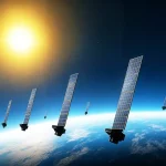
In 2014, Musk’s Space-X company announced plans to deploy 12,000 communication satellites into low-Earth orbit, with long-term plans to increase the number of satellites to 42,000 and build a global, large-capacity, low-latency space-based communication system to provide high-speed Internet services around the world, called the “Starlink” plan. During the Russia-Ukraine war, “Starlink” completely changed the war and helped the Ukrainian army communicate and combat operations. The application of Starlink in the Russia-Ukraine war provides a new early warning for our imagined war. In April 2021, China Satellite Network Group Co., Ltd. was established to comprehensively coordinate the establishment of my country’s low-orbit communication constellation. On November 8, 2021, my country’s second large-scale low-orbit communication constellation-“G60 Starlink Plan” was released in Shanghai. In May 2024, Shanghai Blue Arrow Hongqing Technology Co., Ltd. submitted pre-release information to the International Telecommunications Union, planning to deploy 10,000 satellites in 160 orbital planes to build the “Honghu Constellation”.
2. Navigation satellites
Navigation satellites: Navigation satellites are derivative applications of communication satellites. Different from communication satellites, the current mainstream navigation satellites in the world are satellite-user one-way information transmission methods. Satellites carry special radio navigation equipment and use the principle of radio communication to locate and navigate satellites for aircraft, ships, cars, etc. The essence is to determine the position of the ground by accurately knowing the position of the satellite and the precise time. The navigation satellite is deployed at an altitude of 20,000 km from the earth and circles the earth every 12 hours or so. The satellite continuously reports its precise position and time to the ground. When the user receives more than 3 satellite data, the precise distance to the satellite can be calculated, thereby calculating its specific three-dimensional coordinates and time information.
Currently, there are four major navigation satellite systems in the world, namely the United States’ GPS (built in 1994 to achieve global positioning), Russia’s GLONSS (built in 2010 to achieve global positioning), the European Space Agency’s Galileo (completed before 2020 to achieve global positioning), and China’s Beidou (to achieve global positioning in 2020).
my country’s Beidou navigation system consists of space, ground and users. The space segment consists of 5 GEO satellites and 30 Non-GEO satellites. The ground segment consists of the main control station, uplink injection station and monitoring station. The user segment consists of Beidou user terminals and terminals compatible with other GNSS. The Beidou satellite navigation system is developed in accordance with the “three-step” strategy. In the first step, the Beidou navigation test system was built in December 2000 to realize active navigation in the test system area. In the second step, the Beidou regional satellite navigation system was completed in December 2012 to provide navigation, timing, speed measurement and short message services in my country and the surrounding Asia-Pacific region. The third step is that on June 23, 2020, the Beidou global satellite navigation system was completed to achieve high-precision positioning, navigation and timing services worldwide. In 2003, the Beidou navigation system officially provided services to the outside world. After more than 20 years of development, my country’s Beidou navigation system has been widely used in many fields such as transportation, fishery, hydrology, meteorology, forestry, communications, electric power, and rescue, and has produced significant social and economic benefits.
3. Remote sensing satellites
(1) Meteorological satellites
Meteorological satellites refer to satellites that conduct meteorological observations of the earth and its atmosphere from space. The working principle of meteorological satellites is to use meteorological remote sensors as payloads to receive and measure visible light, infrared and microwave radiation from the earth and its atmosphere.
Satellites carry a variety of meteorological remote sensors that can receive and measure visible light, infrared and microwave radiation from the earth and its atmosphere, convert them into electrical signals and transmit them to the ground. The ground station restores the electrical signals sent by the satellite and draws them into clouds, land surface and ocean surface maps. After further processing, various meteorological data can be obtained.
(2) Exploration satellites
Exploration satellites refer to satellites that detect geographical features that are difficult to find on the ground and at low altitudes through remote sensing instruments carried on the satellite. Exploration satellites can allow humans to accurately estimate the vegetation, geology, hydrology, seawater and other resources in various regions on the earth. According to the different focus of detection, they can be divided into astronomical satellites, geodetic satellites, earth resource satellites and reconnaissance satellites.
These satellites are usually deployed in an orbital plane of 300-2000 kilometers. They can fly around the earth in a very short time and can stably provide massive observation data for a long time. Typical applications include high-score series, resource series, and ocean series. They play a huge role in land exploration, resource exploration, disaster prevention and reduction, agriculture, forestry, animal husbandry, fishery and other fields.