
Tag: multispectral imaging
-
China Launches First Wuyang Satellite for Low-Latitude Earth Observation
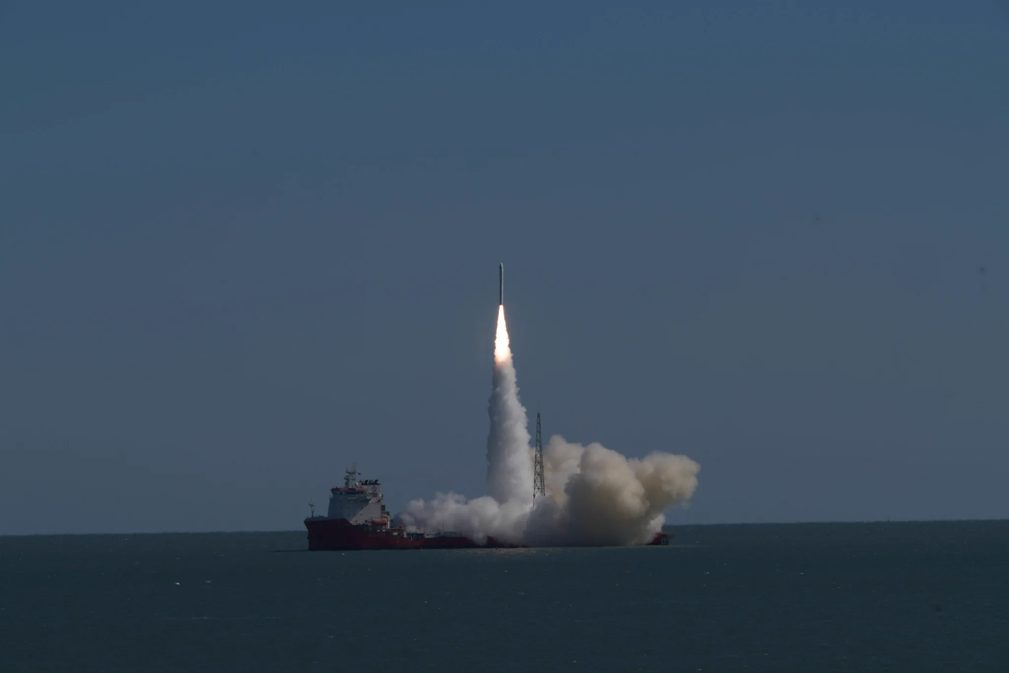
China launched Xiguang-4 01, also known as Wuyang Constellation Pathfinder A, on October 21, beginning in-orbit validation of a remote-sensing network designed to provide more frequent observations of low- and middle-latitude regions. The satellite lifted off at 11:39 a.m. Beijing time aboard Galactic Energy’s Ceres-1S Y8 rocket from the Dongfang Hangtiangang launch vessel in waters…
-
Can Satellite Imagery Measure Shallow-Water Depth?
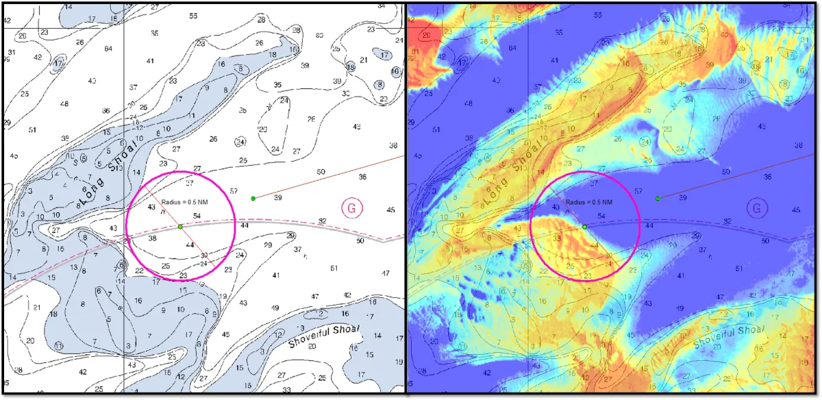
Yes, satellite imagery can estimate shallow-water depth where enough light reaches the bottom and returns to the sensor. This approach, known as satellite-derived bathymetry (SDB), can help map coastal shallows, identify possible shoals and prioritize areas for detailed surveys. Its usefulness depends on water clarity, bottom conditions, image quality and validation against reliable depth measurements.…
-
How Reliable Is Satellite-Derived Water Turbidity?
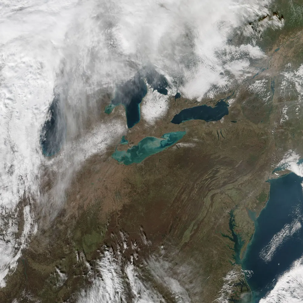
Satellite-derived turbidity can support reliable monitoring of sediment plumes, seasonal patterns and unusual changes across rivers, lakes and coastal waters. Its reliability, however, depends on whether the imagery, processing method and retrieval algorithm have been validated for the conditions being monitored. A convincing map is not enough: users need to know how closely the estimates…
-
The Need for Environmental Impact Assessments of Oil Fields
Environmental impact assessments of oil fields are a common practice in the industry due to the risks involved in oil exploration and production. From land degradation to water contamination, the ecological footprint of oil fields can be substantial. As companies strive to balance resource extraction with environmental responsibility, advanced monitoring solutions are needed to track…