However, that is just data, and while data is king in the technology-focused world we live in, it’s useless if you can’t do anything with that data. Good thing this data is far from useless, with it being used to create 3D maps of the land with crazy detail. These maps can show the complex structures of bridges, power lines, buildings, and land elevation. Some use cases for these maps include emergency disaster response, engineering reviews, and climate studies of changing water levels and erosion.
Join our Discord Server: Join the community with forums and chatrooms about space!
Why is this a new thing for space?
Typically if you want to get LiDAR mapping of your proper, you have to turn to aircraft or drones. Drone LiDAR mapping has become a rather popular item for companies like DJI, Skydio, and Autel. All three companies build drones to fly automated flight plans around buildings or open land and generate a map within minutes. Skydio has even taken this to the military with its X2 drone, saying forces out in the field can easily create maps of villages.
The downside of the current mapping industry is that you either need to hire a full-time pilot with expensive equipment and training costs or contract a company to do it for you, which might not be the fastest. However, NUVIEW is looking to change that now that technology has evolved enough for on-orbit LiDAR mapping.
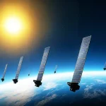
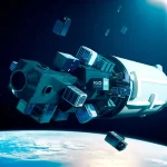
With the ability to now build smaller satellites that can support the power needed for LiDAR technology, NUVIEW is looking to move that data collecting to space. The company announced earlier this month that it will launch 20 satellites into low Earth orbit to generate the first 3D map of the entire globe.
NUVIEW has already finished a design review of its LiDAR payload and is now working on growing its team to start the construction of its first satellite. This will take about three years, the company says to get it to launch, but after that, one could be launched every 18 months.
Once the constellation is complete, NUVIEW wants to produce a new 3D map of the globe every year, providing a slew of new research and operational opportunities to potential customers.