
Tag: satellite data
-

China Uses Fengyun Satellites and MAZU to Support Cross-Border Disaster Monitoring in Nepal
On Aug. 26, a high-altitude ice-and-rock avalanche occurred on the Nepalese side of the border, triggering a chain of cross-border debris flows that caused significant casualties and left people missing at Gyirong Port in China’s Gyirong County. Following the disaster, the China Meteorological Administration activated the Fengyun International User Disaster Prevention and Mitigation Emergency Support…
-

China’s First Cross-Border Satellite Data Processing and Trade Zone Unveiled in Wenchang
The Hainan Aerospace Data Cross-Border Processing and Trade Zone was officially unveiled at the opening ceremony of the 2026 Wenchang International Aviation and Aerospace Forum on Aug. 25. As China’s first trade zone dedicated to the cross-border processing of satellite data, it will leverage the policy advantages of the Hainan Free Trade Port and Wenchang’s…
-

Rwanda and Planet Labs Launch National Satellite Data Program for Government, Universities and Startups
The Government of Rwanda has partnered with Planet Labs to establish a national satellite data program that will provide near-daily Earth observation imagery to government agencies, public universities, selected startups and strategic development partners. Managed by the Rwanda Space Agency, the program is designed to make satellite imagery a more routine component of national decision-making,…
-
From Remote Sensing Satellites to Intelligent Satellites: A New Direction for China’s Commercial Space Industry
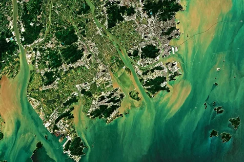
As the commercial space industry enters its second half, the satellite applications market is increasingly driven by cost efficiency and is, in turn, pushing upstream remote sensing satellite manufacturers toward a new paradigm of integrated sensing and computing. China has now entered the era of intelligent satellites. Why has onboard intelligence become a necessity for…
-

Network Rail Tests Satellite Analytics To Predict Flooding And Vegetation Risks
Network Rail, the owner and operator of Britain’s railway infrastructure, has partnered with Earth observation analytics company CATALYST, part of PCI Geomatics, on a 12-week pilot exploring how satellite data could help identify weather-related risks to railway infrastructure across the Wessex Route before disruption occurs. The pilot brought together Network Rail’s Wessex Route Operations and…
-

After the China-Saudi Space Agreement: Satellite Data Is Turning Into Real Savings
On July 13, 2026, China National Space Administration (CNSA) Administrator Shan Zhongde met in Beijing with Abdullah Alswaha, Saudi Arabia’s Minister of Communications and Information Technology and Chairman of the Board of the Saudi Space Agency. The two sides discussed cooperation across deep space exploration, space debris mitigation, and communications satellites under a bilateral space…
-

Data Security and Sovereignty Concerns: What Satellite Buyers Need to Know
For many international satellite customers, technical performance is only part of the purchasing decision. Equally important is a question that often arises early in procurement discussions: who controls the data? Governments, infrastructure operators, research organizations, and commercial satellite owners increasingly view satellite data as a strategic asset. As a result, concerns about data ownership, system…
-

Export Compliance and Satellite Data Regulations: What International Satellite Buyers Need to Know
For many international satellite buyers, one of the first questions is not about payload performance, imaging resolution, or launch vehicles. Instead, it is whether the satellite, technology, and data can be legally exported, transferred, and operated without creating future regulatory risks. In fact, export compliance is often one of the earliest topics raised during discussions…
-

How does satellite data improve utility maintenance planning?
Satellite data significantly improves utility maintenance planning by providing timely, large-scale insights into infrastructure conditions, environmental risks, and operational priorities. By enabling utilities to monitor extensive asset networks more efficiently, Earth observation technologies support proactive maintenance strategies that help reduce costs, improve reliability, and enhance operational resilience. Traditional maintenance planning often relies on scheduled inspections,…
-

Can satellites help detect pipeline or telecom asset issues?
Yes, satellites can play an important role in detecting and monitoring conditions that may affect pipeline and telecommunications infrastructure. While satellites generally do not replace detailed engineering inspections or field-based monitoring systems, they provide valuable large-scale visibility that helps operators identify potential issues, prioritize maintenance activities, and improve risk management across extensive asset networks. Pipeline…