In May 2026, conventional vessel-tracking maps showed major information gaps around the Strait of Hormuz. The gaps did not necessarily mean that the vessels had left the area.
According to Windward, dark-vessel activity in and around the Strait increased by nearly 600% between April 19 and May 3. On May 5, its multi-source analysis identified 167 commercial-size vessels in the area, 146 of which it classified as operating dark. Subsequent imagery showed commercial-size vessels continuing to transit the Strait without corresponding AIS tracks.
Operating without a corresponding AIS track does not necessarily indicate illegal activity. In waters exposed to heightened conflict risk, some commercial vessels may temporarily stop broadcasting their positions to reduce the risk of being tracked or attacked. But when large numbers of vessels disappear from conventional tracking systems at the same time, legitimate navigation, equipment failure, precautionary concealment, and deliberate evasion become difficult to distinguish. A blank space on an AIS screen may mean that a vessel has left, stopped transmitting, or was not successfully received—or that it does not want to be seen.
A Washington Post analysis of satellite imagery and vessel-tracking data indicated that at least 13 laden tankers had transferred Iranian crude to other tankers near Indonesia’s Riau Archipelago. Tanker Trackers estimated the total volume at approximately 22 million barrels. Some of the vessels involved rarely broadcast AIS positions and operated through opaque ownership or management arrangements. Track analysis also found that two tankers apparently heading toward the transfer area had perted through the Lombok Strait. Analysts suggested that they may have been avoiding the Strait of Malacca, where vessel activity is more easily observed.

Satellite images captured near Indonesia’s Riau Archipelago after the U.S. blockade on Iranian exports began show nine tankers offloading Iranian oil in ship-to-ship transfers. Credit: European Space Agency and Planet Labs. Source: The Washington Post.
A vessel can switch off AIS, alter its route, or change its name or flag, but it cannot truly disappear from the sea. It may still be detected by coastal radar or appear in satellite imagery. Its movement may leave a wake, its approach to another vessel may alter its movement pattern, and a cargo transfer may be accompanied by changes in loading, the vessel’s visible waterline, an oil slick, or the surrounding water.
The real challenge is not obtaining any single type of data. It is connecting these scattered clues to understand what is actually happening at sea. See how multi-source data can strengthen maritime monitoring →
Why Existing Maritime Monitoring Still Leaves Gaps
That begins with understanding what existing maritime-monitoring systems can already see, where their coverage ends, and what additional evidence is needed to close the remaining gaps.
Maritime smuggling is not limited to one type of cargo or vessel. Crude oil, refined fuels, narcotics, weapons, endangered wildlife products, and other contraband can all enter cross-border transport networks by exploiting the scale and complexity of legitimate shipping.
Maritime authorities often already have AIS, Vessel Traffic Services (VTS), coastal radar, vessel databases, watchkeeping personnel, patrol assets, and emergency-response mechanisms. The problem is rarely a complete lack of monitoring capability. It is that each system sees only part of an event, and those parts are not always connected across the same time, position, vessel identity, and operational context.
Coastal radar can continuously detect nearshore targets, but its coverage is constrained by station location and range. AIS can establish vessel identity and track history, but only when a vessel transmits actively, consistently, and truthfully. Patrol vessels, aircraft, and drones can conduct on-site checks, but cannot indiscriminately cover vast areas of ocean. Port and customs records can reveal cargo risk, but may not show what a vessel did while it was far offshore.
An interruption in AIS transmission may be deliberate, but it may also result from equipment failure, signal collision, or insufficient receiver coverage. Two vessels approaching each other at sea may be conducting routine resupply or an undeclared cargo transfer. A radar target without a corresponding AIS signal does not, by itself, prove illegal activity.
Maritime risk is rarely explained by a single signal. More reliable assessments come from continuously connecting information from different systems around the same target, track, and event.
Satellites become most valuable where these systems leave uncertainty: beyond coastal coverage, during gaps in cooperative tracking, or when an independent observation is needed to verify what is physically present at sea.
What Different Types of Satellite Data Can Reveal
Maritime authorities face questions that go well beyond simply asking whether a vessel is present.
Sometimes the task is to confirm that a target actually exists. In other cases, it is to investigate whether a vessel may have stopped transmitting or falsified its AIS data, observe whether two vessels are alongside one another, or investigate changes involving surface materials, emissions, oil slicks, or the surrounding water.
Different satellites reveal different aspects of the same event. Only by connecting these observations with coastal radar, vessel records, port data, and field information can analysts gradually reconstruct a target’s identity, track, and behavior.
Satellite AIS: Extending Vessel Identity and Tracks Farther Offshore
AIS provides identity, position, speed, course, and other information actively broadcast by a vessel. Compared with shore-based receivers with limited range, satellite AIS can receive vessel signals across much wider areas, helping analysts fill gaps in long-distance tracks and observe movement between different waters and ports.
Continuous AIS records can also establish a vessel’s normal behavioral baseline. If it suddenly deviates from a familiar route, remains in sensitive waters for an extended period, or stops transmitting before or after approaching another vessel, that part of the voyage can be flagged for further review.

Ship observations collected by Norway’s AISSat‑1 over a 24-hour period. Colors indicate observation frequency(red->yellow: fewer observations, green->blue: more observations); dense traffic areas can create message-collision challenges for satellite AIS reception. Credit: Norwegian Defence Research Establishment/ESA.
Satellite AIS expands coverage, but it still depends on active transmission. Identity misuse, position spoofing, equipment failure, and changing reception conditions can all create missing or inaccurate tracks. AIS can tell us who a vessel claims to be and where it reports itself to be, but it cannot independently prove the target’s true position or activity.
SAR Satellites: Finding Physical Targets at Night and Through Cloud
Synthetic aperture radar actively transmits microwave signals toward the sea surface and does not depend on sunlight, allowing it to operate at night and under many cloud and rain conditions. Because metal hulls typically produce a different radar response from the surrounding water, SAR is an important tool for detecting vessels without corresponding AIS tracks and verifying targets of interest.
Matching vessels detected in SAR imagery with AIS records from the same time window can reveal cases in which a vessel is visible in the image but has no corresponding AIS target. It can also expose significant discrepancies between a vessel’s imaged location and its reported position. For some fast-moving targets, the wake may provide additional clues about direction and movement.
SAR can also help identify suspected oil slicks. Oil changes the structure of short surface waves and, under suitable wind and sea conditions, can create a radar signature that differs from the surrounding water. Low-wind areas, natural seepage, and other ocean phenomena can produce similar patterns, however. Meteorological and sea-state data, optical or hyperspectral observations, and nearby vessel tracks are needed to reduce false positives.
SAR is particularly useful for answering the question, “What is physically present on the sea?” But a single image records only one moment, and detection performance is influenced by vessel size, sea state, spatial resolution, and imaging mode.
Optical Satellites: Assessing Vessel Type and Visible Activity
High-resolution optical imagery provides a more intuitive view of a target, including hull dimensions, deck layout, hatch count, mast position, and superstructure. These features can help distinguish tankers, bulk carriers, fishing vessels, refrigerated cargo vessels, and small boats. They can also be used to compare a vessel’s appearance before and after a change of name.
In an offshore transfer scenario, optical imagery can show whether two vessels remain alongside each other for an extended period. Multi-temporal imagery can also record visible changes before and after an encounter. When combined with AIS-reported draught, the visible waterline, track history, and cargo information, these observations can help assess whether the vessel’s loading may have changed.
Even if a vessel changes its name, flag, or AIS identity, its hull proportions, mast positions, and deck configuration are difficult to alter at the same time. Comparing imagery collected at different times and locations can help determine whether two apparently different identities may belong to the same vessel.
Optical satellites also have clear limitations. Cloud, haze, darkness, solar elevation, and tasking windows can all affect image acquisition. Optical data is therefore often used alongside SAR to provide more intuitive visual verification of a target that has already been detected.
Hyperspectral Satellites: Using Spectral Signatures to Support Vessel Identification
Conventional optical imagery records a limited number of visible and near-infrared bands. Hyperspectral sensors record reflected energy across many narrow, contiguous bands. When spatial resolution, illumination, and atmospheric conditions are suitable, vessel surfaces, coatings, residues, and the surrounding water may produce different spectral responses, potentially supporting vessel classification, anomaly analysis, and re-identification hypotheses across time.
Hyperspectral data has also been used to investigate oil slicks and water anomalies. If SAR detects a tanker without corresponding AIS data, optical imagery shows it remaining alongside another vessel, and hyperspectral data indicates a possible oil-related or other surface anomaly nearby, the observations may collectively strengthen the case for further investigation.
These capabilities are still developing. The spatial resolution, revisit frequency, and processing efficiency of some current spaceborne hyperspectral sensors are not yet sufficient to identify every vessel or material consistently. Hyperspectral imagery also cannot determine what is inside a sealed cargo hold. It is better understood as an additional evidence layer alongside SAR, optical imagery, and AIS.
Satellite AIS records the identity and track a target actively reports. SAR verifies physical targets on the water. Optical imagery provides vessel-type and activity features. Hyperspectral data may add clues relating to suspected oil slicks, water anomalies, exposed vessel-surface materials, and—in suitable conditions and with appropriate spectral bands—certain atmospheric plumes. These technologies are complementary, and there is no need to use all of them in every case.
The right data depends on the question that needs to be answered. Explore STARPATH GLOBAL satellite imagery capabilities →
Different Smuggling Activities Require Different Monitoring Capabilities
Once the basic capabilities of each satellite type are understood, the next step is not to impose a fixed sensor sequence. It is to start with the behavioral and physical signals that a particular form of smuggling may leave behind, then select an appropriate combination of data.
Crude Oil and Fuel Smuggling
Crude oil and refined-fuel smuggling often involves tankers, supply vessels, offshore anchorages, and ship-to-ship transfers. Because the targets are relatively large and transfers can take considerable time, this activity is comparatively well suited to satellite monitoring.
AIS and vessel records can first reveal unusual rerouting, prolonged low-speed encounters, repeated identity changes, or signal loss in high-risk waters. SAR can verify whether a tanker remains in the area and detect vessels without corresponding AIS records or suspected surface oil slicks. Optical imagery can provide a closer look at vessel type, alongside arrangements, and visible changes such as the vessel’s waterline. Combined with AIS-reported draught, track history, and cargo information, these observations may help assess whether the vessel’s loading condition changed. Hyperspectral data may add supporting evidence for suspected surface oil or other material anomalies.

Envisat ASAR imagery of the Deepwater Horizon oil spill. Surface oil appears dark because it smooths short wind-generated waves, although similar dark signatures can also arise from other ocean conditions. The white dots are oil rigs and ships. Credit: ESA. Licensed under CC BY-SA 3.0 IGO.
An oil slick alone does not prove crude-oil smuggling. What matters is whether its location, wind and current conditions, nearby vessel tracks, alongside activity, and multi-sensor observations point to the same event.
Drugs, Weapons, and Human Smuggling
These activities often involve small speedboats, fishing vessels, or modified conventional craft. The targets may never transmit AIS, may travel quickly, and may have short departure and landing windows. They may also exploit darkness and complex nearshore environments to avoid detection.
Coastal radar, VTS, nighttime surveillance, radio monitoring, drones, and patrol forces usually provide more continuous detection. Track analysis can flag unusual departure times, repeated trips, high-speed movement inconsistent with normal operations, and offshore encounters between mother ships and small boats.
High-resolution SAR or optical satellites can supplement shore-based blind spots, verify known rendezvous locations, and help analyze longer-term activity patterns. For fast-moving small boats, however, satellite imaging remains constrained by target size, sea conditions, and revisit time. Hyperspectral data has a relatively limited direct role in this type of smuggling, and final determinations still depend on interception, boarding, and cargo inspection.
Illegal Catch and Endangered-Species Trafficking
The key is not merely to find a fishing vessel, but to determine whether it is operating at a permitted time and place, using an authorized method.
AIS and vessel monitoring systems can establish the tracks of cooperative fishing vessels. SAR can detect targets that are absent from available AIS or vessel monitoring system records, while optical imagery can help confirm vessel type, operating status, and whether a fishing vessel has come alongside a refrigerated carrier. For fleets that use powerful lights while fishing, nighttime light data can add another observational layer.
These observations must also be connected with fishing permits, closed areas, closed seasons, and historical operating patterns. A fishing vessel following a normal track within an authorized area presents a very different risk profile from one that enters a closed area, switches off its signal, and later meets a transport vessel.
Contraband Concealed in Containers and General Cargo
When prohibited goods are hidden inside ordinary containers or legitimate cargo, satellites have a clear limitation. Imagery cannot see through a sealed container or determine from a vessel’s appearance whether its cargo is legal.
These risks depend more heavily on customs declarations, manifests, supply-chain relationships, port records, cargo-risk profiles, and physical inspection. AIS and satellite imagery can verify surrounding activity: whether a vessel visited an undeclared location, made an unusual port call, stopped transmitting during a voyage, or followed a route inconsistent with its declarations.
In this scenario, satellites are not cargo-inspection tools. They provide an additional means of verifying the integrity of the transport chain.
No single satellite can address every form of smuggling. A more effective approach begins by identifying the behavioral and physical traces an activity may leave, then selecting appropriate data for detection, correlation, and verification.
Unsure which monitoring combination fits a particular risk scenario? Get sensor recommendations tailored to your target area and mission →
China’s Ocean Satellites Are Expanding the Data Foundation for Maritime Monitoring
The monitoring framework described above depends on access to multiple types of satellite data. China’s expanding ocean-observation system—including capabilities for ocean dynamics, ocean color, maritime surveillance, and vessel-information acquisition—shows how this foundation is moving from inpidual missions toward constellation-based and sustained services. The Haiyang‑2 series illustrates that progression.
| Satellite | Launch | Role and development |
|---|---|---|
| HY‑2A | 2011 | China’s first ocean-dynamic-environment satellite. It observed sea-surface height, significant wave height, sea-surface wind fields, and sea-surface temperature, laying the foundation for subsequent operational missions. |
| HY‑2B | 2018 | Continued ocean-dynamic observations and introduced the Automatic Identification System and Data Collection System to the HY‑2 series. |
| HY‑2C | 2020 | Joined HY‑2B as part of the operational network. Its AIS payload incorporated designs addressing signal collisions, satellite-platform electromagnetic interference, and low-signal-to-noise reception; the relevant designs were subsequently validated in orbit. |
| HY‑2D | 2021 | Completed the three-satellite HY‑2B/C/D constellation and added dual-mode GPS and BeiDou data reception to strengthen navigation autonomy. |
| HY‑2E | 2026 | Launched to succeed HY‑2B and maintain operational observations alongside HY‑2C and HY‑2D. It also carries AIS and Data Collection System payloads. |
Official sources reported that the HY‑2 network was designed to monitor approximately 80% of global sea-surface wind fields within six hours. This figure refers specifically to sea-surface wind-field coverage; it is not an AIS vessel-detection rate, a vessel-track refresh interval, or a six-hour global-coverage claim for every ocean-dynamic variable.
From HY‑2A’s initial ocean-dynamic observations to the HY‑2B/C/D constellation and HY‑2E’s continuation of operational capability, the program has progressed from an inpidual mission toward constellation-based and sustained services.

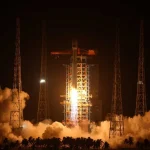
A Long March-4B rocket carrying the Haiyang-2E satellite blasts off from the Jiuquan Satellite Launch Center in northwest China, July 2, 2026. Photo by Wang Jiangbo/Xinhua.
China’s SAR, optical, and hyperspectral capabilities are also continuing to develop. Satellite availability is only one part of an operational monitoring system, however. Time synchronization, identity correlation, quality control, risk prioritization, and field feedback determine whether observations can be converted into actionable and auditable maritime events.
How STARPATH GLOBAL Turns Satellite Observations into Maritime Events
Satellites cannot solve maritime smuggling on their own, and a single image cannot establish that a violation has occurred. Their value comes from connecting independent observations with existing systems and narrowing a large volume of anomalies to the targets that genuinely warrant attention.
STARPATH GLOBAL helps maritime organizations connect satellite observations with existing AIS, VTS, coastal radar, vessel records, and operational workflows. We begin with the problem a client needs to solve, then assess where satellite data can add observation, provide verification, or narrow the scope of field searches.
Depending on the mission, the data mix may include satellite AIS, SAR, optical, or hyperspectral imagery. For oil transfers, this may involve AIS anomaly analysis, SAR vessel detection, and optical verification of alongside activity. For small-boat smuggling, coastal radar, track analysis, satellite imagery, and field patrols may need to work together. For illegal catch, vessel observations can be connected with permits, closed areas, and transport networks. For containerized contraband, cargo and port data remain central, while satellites help verify routes, unusual port calls, and undeclared stops.
STARPATH GLOBAL does not treat satellite imagery as the final product. Depending on project scope and available data, outputs may include targeted imagery, vessel or target lists, event-based analysis, and reports that support monitoring, investigation, or response.
Through its Forward Deployed Engineer (FDE) model, STARPATH GLOBAL works with clients to identify high-value use cases, select suitable data, design monitoring workflows, and validate them in real target areas. Through the StarPath Pioneer Partner Program, selected organizations can assess and validate one priority use case before considering broader deployment.
Start with one priority area and validate the operational value of multi-source monitoring.