Tag: Satellite Imagery
-
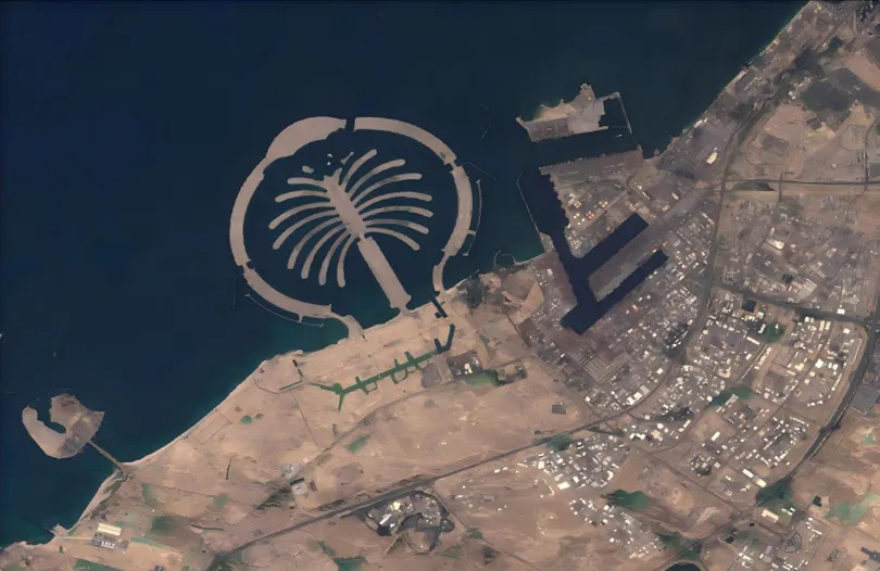
When the Desert Flooded: Satellite Imagery and the Future of Agricultural Flood Insurance
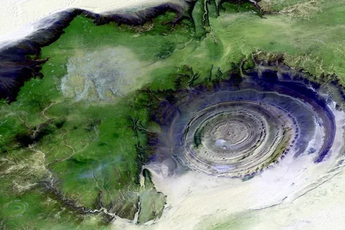
The April 2024 UAE floods stress-tested every traditional risk assessment model. STARPATH GLOBAL satellite imagery shows how Earth observation is transforming how agricultural insurers detect, verify, and price catastrophic flood events. Published: April 2024 · Region: United Arab Emirates · Data: STARPATH GLOBAL · USGS Event Background A once-in-75-year rainfall event On April 16, 2024,…
-
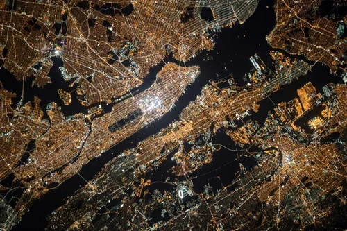
Evaluating Satellite Imagery Providers: What Enterprise Leaders Need to Know
Satellite imagery has moved far beyond the realm of government agencies and specialized scientific groups. Today, it’s a critical asset for enterprises across agriculture, insurance, energy, and logistics. If you need to monitor crop yields in Brazil, assess flood risk in Florida, or track shipping containers in Singapore, views from orbit provide the ground truth…
-
How Satellite Imagery Helps Enterprises Stay Ahead of Regulatory Compliance
Regulatory compliance is rarely the most glamorous part of business operations, but for industries like mining, energy, and construction, it is arguably the most critical. One missed report or unnoticed environmental violation can lead to hefty fines, project shutdowns, or reputational damage. Traditionally, monitoring compliance meant sending teams into the field, which is expensive, time-consuming,…
-
Satellite Imagery Pricing: What You Need to Know
For project managers in mining, energy, and government, having the right data is not just an advantage, it’s essential for safety, compliance, and operational efficiency. Satellite imagery provides a powerful, objective view of your assets and areas of interest, enabling smarter decisions from the office to the field. But as you look to purchase satellite…
-
Highest Resolution Satellite Imagery: What You Should Know
Access to clear, precise geospatial data is completely changing how organizations work. For industries like mining, energy, government, and urban development, the ability to see our planet in amazing detail is a game-changer. Leaders can now make smarter, faster decisions that improve compliance, safety, and operational efficiency. Thanks to incredible advancements in technology, today’s highest…
-
What Is Temporal Resolution?
Temporal resolution, also known as re-visit rates, vary from different providers. Temporal resolution provides information on the time difference between the acquisitions of two images over the same area. Above all, the higher the temporal resolution, the shorter the time difference between the image acquisitions. Each satellite has a maximum number of visits per day…
-
What Is Archive?
Archive satellite imagery is a purchasing option for imagery that has already been collected. Archive imagery can be passively collected by satellites that continuously image the Earth. It can also be collected in response to tasking requests submitted for specific areas. Those who task imagery through providers agree to licensing and sharing terms, allowing individuals…
-
What is AOI?
AOI is an acronym for “Area of Interest.” Knowing your desired AOI will help you in planning your data collection with satellites to ensure you get the right technology in the right place and at the right time. In satellite imagery ordering and tasking workflows, an AOI describes the location for which you are requesting…
-
How to Choose the Right Satellite Imagery Provider
Choosing the right satellite imagery provider for your project can feel overwhelming, but it comes down to your goals and accessing the right features. When seeking a satellite imagery provider, ask yourself critical questions about what type of data you’re looking for. Do you need high-resolution images? Are you looking to collect data in an…