Over the past decade, the commercial space industry has transformed satellites from assets reserved for national-level missions into industrial products that can be mass-produced and deployed on demand. As thousands of low-Earth-orbit broadband, remote-sensing and navigation satellites form constellations, space is taking on the characteristics of infrastructure for the first time—continuously providing connectivity, observation and positioning services on Earth rather than merely supporting scientific research.
Publicly documented cases from a series of regional crises in recent years have demonstrated this shift. When terrestrial communications, power grids or port facilities are damaged in emergencies, commercial satellite communications and remote-sensing networks are often called upon to maintain connectivity and provide reliable observation.
Space has consequently entered the discussion about critical infrastructure, creating one of the most dependable sources of long-term demand for the commercial space industry.
1. When Terrestrial Networks Fail, Why Can LEO Satellites Keep Users Connected?
When terrestrial communications go down, low-Earth-orbit broadband constellations can maintain connectivity. Commercial communications satellites have become a form of critical infrastructure.
When conventional communications and command networks are damaged, a party may still be able to maintain basic communications and coordination because of the LEO broadband constellation overhead. By filling the connectivity gap left by failed terrestrial networks, commercial satellite communications have provided a public demonstration of the commercial space industry’s capabilities.
As of 2026, Starlink had approximately 10,400 active satellites in orbit, representing about 65% of all active satellites worldwide. Its user base had surpassed 10 million across more than 160 countries.
Starlink’s resilience stems from its distributed architecture. The failure of one satellite does not disrupt the entire network. The cost of user terminals has fallen by nearly 60% within several years, while median latency has dropped to about 25 milliseconds, bringing the user experience close to that of terrestrial fiber-optic networks.
Satellite internet is therefore no longer merely a supplementary service useful only in remote areas. It has become a backbone connection capable of serving as a fallback when terrestrial infrastructure fails.
China’s Spacesail Constellation, also known as Qianfan, and China SatNet’s satellite internet constellation have entered the network deployment stage. Their value extends beyond internet access. They can provide resilient connectivity for emergency response, maritime operations, aviation and border regions where terrestrial networks remain weak. This is where commercial space is evolving from simply “putting satellites into orbit” into the provision of critical infrastructure.
2. Why Do Navigation, Bank Reconciliation and Power-Grid Synchronization All Depend on BeiDou?
Navigation satellite systems such as BeiDou have become fundamental to the operation of modern society. If their signals are disrupted, the effects extend far beyond the military to aircraft, ships, financial systems and power-grid clocks.
Navigation satellites are not simply there to support maps on mobile phones. Positioning, navigation and timing, or PNT, underpins an entire network of modern operations. Drone deliveries, precision agriculture, timestamps for financial transactions and the synchronization of power grids and telecommunications base stations all depend on stable timing signals.
BeiDou, one of the world’s four global navigation satellite systems, also offers a distinctive short-message communication service that can transmit critical information even when terrestrial communications are unavailable.
Yet the deeper the dependence, the more apparent the vulnerabilities become. Navigation signals are already extremely weak by the time they travel from space to Earth, making them susceptible to jamming, which overwhelms legitimate signals, and spoofing, which transmits false positioning data.
According to the BBC, more than 800 flights worldwide were affected by GNSS spoofing or interference on an average day in 2026. In the Persian Gulf, the number of flights reported to have encountered GPS spoofing in a given month surged from 14 in January to 5,381 in March. Annual cases in the Baltic region also rose from approximately 17,000 in 2024 to about 59,000 in 2025.
The spillover effects are even more concerning. Commercial vessels in the Black Sea and the Persian Gulf have reported apparent “position drift” or being shown circling in place, directly increasing shipping and insurance costs. GNSS interference is no longer confined to battlefields; it has become a civilian issue affecting both aviation and maritime transport.
How can resilience be strengthened? Internationally, one approach has been to develop anti-jamming capabilities. The encrypted M-Code used by GPS and the Public Regulated Service, or PRS, offered by Galileo provide protected alternatives.
For China, the path forward lies in BeiDou augmentation and diversified PNT backups. A BeiDou-centered system can be supplemented by LEO-based navigation augmentation, ground-based augmentation and integrated sources such as inertial and visual navigation, reducing dependence on any single signal.
3. How Is AI Turning Satellite Imagery From Something We See Into Something We Understand?
Commercial remote sensing has turned high-resolution Earth observation into a product that virtually anyone can purchase. With the addition of artificial intelligence, the industry is moving from merely capturing images to understanding them, placing geospatial intelligence at the center of a fast-growing market.
A decade ago, obtaining clear images of the Earth’s surface was still largely a state-level capability. Today, commercial satellites have turned it into a commodity.
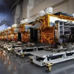
A total of 391 Earth-observation satellites were launched worldwide in 2025, including 221 commercial satellites. By the end of that year, approximately 1,822 Earth-observation satellites were in orbit, with commercial systems accounting for about 78%.
Resolution has also advanced rapidly. Commercial optical satellites now offer imagery at resolutions of about 30 centimeters. Synthetic-aperture radar, or SAR, can also achieve resolutions of approximately 30 centimeters while operating through clouds and at night. Planet operates more than 200 satellites and provides daily global coverage.
AI is the real game changer. In the past, obtaining an image was only the beginning: interpreting it required large teams of analysts. Today, onboard AI and edge computing can identify objects and detect changes in orbit, shortening the time from “image” to “intelligence” from weeks to hours.
China’s Jilin-1 constellation has used proprietary algorithms to automatically identify aircraft, ships, oil tanks, photovoltaic power stations and other objects with accuracy exceeding 95%. This is precisely what geospatial intelligence is about: automatically converting satellite data into information that can support decisions.
The fact that commercial imagery can be purchased by almost anyone has also created regulatory challenges. One commercial remote-sensing company once imposed a 14-day restriction on the release of imagery covering a particular maritime area. The decision highlighted a new question: as high-resolution observation becomes publicly available, how should openness be balanced against risk?
Greater access to commercial imagery is making battlefields more transparent, raising the requirements for concealment, mobility and camouflage.
For Chinese entrepreneurs, the opportunity lies in combining constellations, AI and downstream applications. Jilin-1, developed and operated by Chang Guang Satellite Technology Co., Ltd., has 117 satellites in orbit and plans to expand the constellation to 300 by 2027, demonstrating a viable path toward scale.
Differentiated payloads—including SAR, infrared and hyperspectral sensors—combined with industry-specific data services may offer a more practical business opportunity than simply launching more satellites.
4. Do More Satellites Necessarily Make Space Systems Safer?
More satellites do not automatically mean greater safety. Distributed LEO megaconstellations are more resistant to single-point failures, but they also increase the need for fleet-wide asset protection, collision avoidance and space situational awareness, or SSA.
As noted earlier, distributed deployment allows a network to continue operating when an individual satellite fails. That is the source of a constellation’s resilience. The other side of the equation is that as orbits become crowded, the overall risk of failure—and the risk of being unable to see or manage what is happening—also rises.
The space environment is becoming increasingly congested. Publicly available statistics show that more than 34,000 trackable pieces of space debris larger than 10 centimeters are orbiting Earth at extremely high speeds. The International Space Station alone conducted more than 30 avoidance maneuvers in 2025.
The larger a megaconstellation becomes, the more essential collision avoidance, in-orbit servicing and active deorbiting become.
A corresponding market is taking shape. According to Marketintelo, the global SSA market is projected to grow from approximately $2.1 billion in 2025 to $4.3 billion in 2034, representing a compound annual growth rate of about 8.7%.
Commercial SSA companies are building networks of radar and optical sensors and using AI to predict collisions. Their services are becoming standard infrastructure for constellation operators.
For China, space security is an unavoidable new frontier for the commercial space industry. It encompasses the ability to monitor and manage the country’s three major satellite systems—BeiDou navigation, remote sensing and communications—as well as domestic capabilities in in-orbit servicing, debris monitoring and space situational awareness.
This is the commercial interface most directly connected to the “new space contest.” The issue is not simply how many satellites a country operates, but whether it can protect them.
5. Opportunities and Bottlenecks in Four Major Segments
Remote sensing, communications, navigation and space security each present different opportunities and constraints. Geospatial intelligence and resilient architecture are the common threads running through all four.
- Remote sensing: Jilin-1 has validated the “constellation plus AI” model. Opportunities lie in differentiated payloads such as SAR, infrared and hyperspectral sensors, as well as downstream data services. The main constraints are high-frequency revisit capacity, data compliance and adoption in specific industries.
- Communications and satellite internet: Spacesail and China SatNet have entered the constellation deployment stage. Opportunities can be found in user terminals and industry applications in maritime services, aviation and emergency response. The main obstacles are spectrum coordination and overseas market access.
- Navigation and PNT: With BeiDou at the core, opportunities lie in LEO-based navigation augmentation, ground-based augmentation and diversified, integrated backup systems. Anti-jamming capabilities and cross-system interoperability remain key challenges.
- Space security: China has considerable room for domestic alternatives in SSA, in-orbit servicing and debris monitoring. The sector has started early and benefits from a supportive policy environment, but it still faces constraints in sensor-network construction and data-sharing mechanisms.
Space capabilities are evolving from state-exclusive tools for scientific research and defense into critical infrastructure on which everyone depends—and which almost anyone can purchase.
The contest is not about the number of satellites. It is about building a system that turns space capabilities into reliable infrastructure: constellations provide coverage, AI converts data into intelligence, resilient architectures withstand interference and failure, and rules and protective measures safeguard orbital assets.
For China’s commercial space industry, this represents both an industrial opportunity and an unavoidable challenge. While strengthening its technology, China must also close the gaps linking constellations, AI, resilience and security. That will be essential to converting the potential of space into industrial strength.
Sources for this article: SpaceX prospectus; Jonathan McDowell’s satellite tracking data; BBC/SkAI Data Services; Space Insider; Racurs, Overview of Overseas Earth-Observation Satellite Development in 2025; Science and Technology Daily; Chang Guang Satellite Technology Co., Ltd.; Marketintelo; and other publicly available sources.