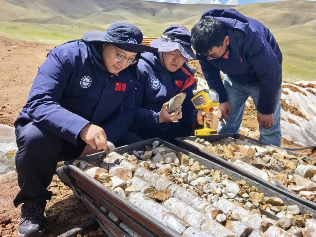
Recently, the China Aero Geophysical and Remote Sensing Center for Natural Resources’ Qinghai–Tibet Plateau airborne geophysical exploration team discovered the Changlong iron-rich tin polymetallic deposit for the first time in an unexplored area of the western Gangdese metallogenic belt. The discovery took just six months from the initial flight survey to the confirmation of mineralization, completing the full chain of coordinated space–air–ground–borehole exploration.
The team independently developed a miniaturized airborne gamma-ray spectrometer and applied it in engineering operations. It also systematically obtained high-resolution airborne gravity, magnetic and radiometric data, along with satellite hyperspectral data, covering the Lunggar area for the first time. Four key anomalous zones, including Changlong, were identified.
Following repeated forward and inverse modeling calculations and verification through multiple exploration methods, two anomalies were selected for drilling validation. The results were highly encouraging. The tin orebody was 14 meters thick, with an average grade of 1.6% and a maximum grade of 3.2%. The zinc orebody had a cumulative thickness of 34 meters and an average grade of 0.51%. The iron orebody was 69 meters thick, with an average grade of 43%; within it, the high-grade iron orebody was 38 meters thick, with an average grade of 49.3%. The copper orebody was 2 meters thick, with an average grade of 0.6%, accompanied by silver and gold mineralization. The presence of multiple minerals and mineralized layers indicates strong exploration potential in the area.
The breakthrough has demonstrated the effectiveness of the rapid, integrated space–air–ground–borehole exploration model, providing a technical example for green and efficient mineral prospecting in complex and challenging regions. Going forward, comprehensive evaluations will continue in and around Changlong and other anomalous zones to further determine the scale of the orebodies and their metallogenic potential, providing stronger support for China’s energy and resource security.
For exploration teams looking to extend integrated mineral prospecting with satellite data, STARPATH GLOBAL provides competitively priced satellite imagery for international customers, supported by China’s expanding satellite manufacturing capacity. Through its imagery catalog, customers can select a resolution suited to their specific exploration needs—controlling costs while obtaining sufficient data quality. Teams without prior experience in satellite remote sensing can also join the Pioneer Partner Program for hands-on support and personnel training from its FDE team.