Kuva Space is advancing Earth observation through the constellation of hyperspectral microsatellites, designed to deliver scientific-grade data and near real-time intelligence for a wide range of commercial, government and environmental applications. By combining hyperspectral imaging, artificial intelligence (AI) and in-orbit data acquisition, the company is building a space-based infrastructure that enables more detailed analysis of Earth’s changing conditions while supporting faster and more informed decision-making. At the center of the company’s technology portfolio is the Hyperfield constellation, which serves as the primary data acquisition system powering Kuva Sense, the company’s planetary intelligence platform.

Kuva Space’s satellite technology is built around the concept of continuous hyperspectral monitoring. This extensive spectral information enables the identification of material properties and surface characteristics that are difficult or impossible to detect using traditional multispectral imagery. By analyzing detailed spectral signatures, users can identify subtle biological, chemical and physical changes occurring across the Earth’s surface. The company’s hyperspectral microsatellites continuously acquire scientific-grade data that forms the foundation of Kuva Sense, providing context-rich information that supports predictive analytics and operational intelligence. Through the combination of advanced satellite sensing and AI-powered analytics, Kuva Space aims to provide organizations with more comprehensive situational awareness across dynamic natural and industrial environments. Kuva Space’s hyperspectral imaging technology is designed to meet the requirements by capturing highly detailed spectral information that enables earlier detection of anomalies and more precise classification of surface materials. The continuous acquisition of scientific-grade hyperspectral data allows decision-makers to monitor evolving conditions with greater confidence while supporting timely operational responses. By providing richer datasets, Kuva Space enables users to move beyond simple image interpretation toward advanced analytical workflows capable of identifying complex environmental and operational patterns. A defining feature of Kuva Space’s satellite technology is the ability to perform continuous measurements across hundreds of spectral bands. Each material on Earth’s surface reflects electromagnetic radiation differently. By collecting information across hundreds of wavelengths rather than only a handful of broad bands, Kuva Space’s satellites provide significantly greater analytical detail. This capability supports advanced applications including vegetation health assessment, soil characterization, water quality monitoring, carbon analysis, mineral identification, environmental change detection and defense-related intelligence.

Many Earth observation applications require information to be delivered quickly enough to support operational decision-making. Kuva Space’s satellite architecture is designed to provide near real-time intelligence, helping users respond more rapidly to evolving events. The company’s integrated data acquisition and processing workflow reduces the time between observation and information delivery, enabling organizations to act on current conditions rather than historical imagery. This near real-time capability is particularly valuable for applications where environmental conditions change rapidly and delayed information may reduce operational value. Another important capability of Kuva Space’s satellite technology is the in-orbit tailored data acquisition approach. The company’s satellites can adapt data acquisition according to specific application requirements. This flexibility enables mission planning to be optimized for different industries, observation priorities and operational scenarios. By designing imaging strategies to user requirements, Kuva Space improves the efficiency of data collection while maximizing the relevance of information delivered to customers. The adaptive approach also supports a broad spectrum of Earth observation use cases without requiring separate satellite systems for individual applications.
Also Read: How Satellite Imagery Is Transforming Greenhouse Gas Monitoring and Carbon Crediting?
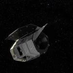
The Hyperfield constellation forms the foundation of Kuva Space’s satellite operations. Each microsatellite is engineered to acquire high-quality hyperspectral datasets that support a wide range of environmental, industrial and commercial applications. The satellites operate as part of an integrated constellation coordinated using artificial intelligence. AI orchestration helps streamline the complete workflow from satellite tasking and data acquisition through processing and analytics. This coordinated operational model enables efficient use of constellation resources while improving observation scheduling and supporting scalable delivery of hyperspectral intelligence across global monitoring applications. The combination of satellite technology and AI also enables Kuva Space to optimize data collection strategies according to changing mission priorities and evolving customer requirements. The first operational satellites within the constellation are Hyperfield-1A and Hyperfield-1B, representing Kuva Space’s first-generation commercial hyperspectral satellites. These spacecraft establish the initial operational capability of the Hyperfield constellation while providing hyperspectral datasets for a growing range of Earth observation applications. In agriculture, hyperspectral observations enable detailed crop monitoring, vegetation health assessment and resource optimization. Aquaculture operators can use hyperspectral data to evaluate water conditions and support sustainable production. Carbon monitoring applications benefit from improved observation of vegetation, ecosystems and environmental changes associated with carbon management initiatives. Environmental organizations gain access to detailed monitoring of ecosystems, land use and ecological change, while defense and security organizations can utilize enhanced spectral analysis for situational awareness and intelligence support.

Kuva Space is continuing the evolution of the satellite technology through the development of Hyperfield-2, which is planned for launch in 2026. The second-generation platform introduces several technological enhancements designed to improve both data quality and analytical capability. Hyperfield-2 will feature expanded spectral coverage together with improved spatial resolution, allowing satellites to capture more detailed information across larger portions of the electromagnetic spectrum. These enhancements will enable users to perform deeper analytical assessments while supporting increasingly sophisticated predictive models built on richer datasets. The upgraded satellite architecture is expected to strengthen the company’s ability to monitor environmental changes, industrial assets, agricultural systems and natural resources with higher levels of detail than previous generations. Potential applications include precision agriculture, environmental protection, climate monitoring, forestry, water resource management, biodiversity assessment, mining, carbon accounting, infrastructure monitoring, maritime operations, disaster response and defense intelligence. The ability to collect detailed spectral information enables organizations to detect changes earlier, classify materials more accurately and monitor complex environmental processes with greater precision. By integrating hyperspectral sensing with AI-driven analytics, Kuva Space provides users with intelligence that extends beyond conventional satellite imagery, enabling more informed decisions across scientific, commercial and public-sector operations. Kuva Space addresses the evolving requirements through the Hyperfield constellation, combining hyperspectral microsatellites, AI-orchestrated mission operations, adaptive in-orbit data acquisition and the Kuva Sense planetary intelligence platform. From the first-generation Hyperfield-1 satellites to the next-generation Hyperfield-2 platform planned for launch in 2026, the company continues to develop technologies that expand the capabilities of hyperspectral Earth observation. By delivering scientific-grade data enriched with advanced analytics, Kuva Space is supporting a broad range of applications that require accurate, timely and information-rich insights.
About Kuva Space
Kuva Space is a space technology company headquartered in Espoo, Finland, focused on delivering hyperspectral Earth observation data and space-based intelligence services. The company develops hyperspectral imaging satellites, satellite constellations and analytics platforms that provide near real-time insights for commercial, government and research applications. The solutions support industries including agriculture, forestry, maritime, environmental monitoring, energy, mining and security by enabling the detection and analysis of materials and changes on Earth’s surface. By integrating satellite technology with advanced data analytics and artificial intelligence, Kuva Space provides actionable Earth observation capabilities for informed decision-making across a wide range of sectors.