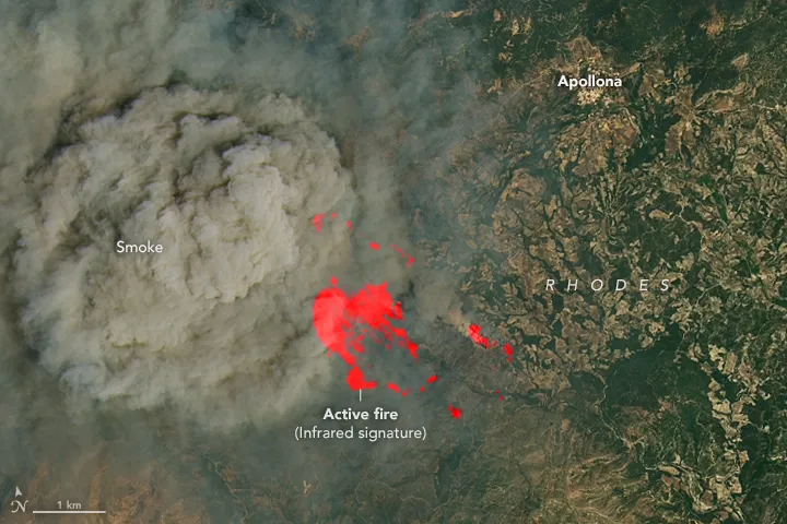
When a wildfire starts, the earliest response window can make an enormous difference. A small fire may still be manageable with limited resources; once wind drives it across the landscape, containment becomes harder, more dangerous and more expensive.
That raises a practical question: with satellites orbiting Earth every day, why have satellite-based alerts sometimes taken hours to reach the people who need them?
Where the Hours Go
A conventional satellite-based wildfire monitoring workflow follows a familiar sequence: capture imagery → downlink data → process it on the ground → distribute information → make response decisions. Each stage may appear reasonably fast on its own, but the delays add up. According to an August 25, 2026 report by CNR citing a Beijing Normal University team, conventional workflows for identifying surface anomalies can take two to six hours.
For a fast-moving wildfire, that is a significant delay. Associated Press reporting on Mediterranean wildfires in June 2026 described how fires can become dangerous within minutes. By the time satellite imagery has been processed and delivered, a small ignition may already have spread across a hillside.
Two bottlenecks are particularly important. Downlinking may require waiting for a ground-station contact window. Ground processing then depends on receiving the imagery before analysis can begin. These stages can account for a substantial share of the time between observation and an actionable alert.
Case Study 1: Muduo 1 Moves Analysis into Orbit
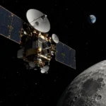
On August 25, 2026, Beijing Normal University launched its two-satellite Muduo 1 experimental constellation. Its approach addresses those delays directly: move more of the analysis onto the satellites.
The two spacecraft divide the work between wide-area screening and detailed inspection. Muduo 1A carries a multispectral instrument to survey large areas and identify potential anomalies. Muduo 1B carries a hyperspectral payload with 26 spectral channels to examine selected targets in greater detail.
When the first satellite identifies a suspected anomaly, inter-satellite communication allows it to pass task information to its partner without waiting for ground-based scheduling. The constellation is designed to analyse observations in orbit and transmit the resulting information, reducing the need to downlink all the raw imagery before an assessment can begin.
The university reported that preliminary tests indicated an average emergency-response processing time of less than one minute. This is an experimental result, rather than a guarantee that any fire anywhere can be detected and reported within a minute. Observation opportunities, communications availability and operating conditions still matter.
Each satellite reportedly supports more than 100 trillion operations per second. Its onboard AI capabilities target more than ten types of surface anomalies, including wildfires, landslides, floods and illegal mining. The models can also be updated in orbit: observations returned to Earth help improve the algorithms, which can then be uploaded to the spacecraft.
Another reported capability is thermal-anomaly recognition at a temperature difference of around 5°C. This could help identify heat signatures associated with early-stage smouldering before obvious flames develop. However, that temperature-difference figure alone does not establish that every smouldering fire will be detectable; the size of the affected area, surrounding conditions and sensor characteristics also influence detection.
Satellite Wildfire Monitoring: Key Figures
- Two to six hours versus under one minute: the conventional workflow described in reporting compared with Muduo 1’s preliminary emergency-response test results.
- Approximately 4 × 4 metres: the reported hotspot detection capability of Greece’s Hellenic Fire System.
- Around 5°C: Muduo 1’s reported thermal-anomaly temperature-difference recognition capability.
- A national firefighting role: Greece has integrated a dedicated wildfire satellite system into its emergency-response framework.
- Approximately US$20 billion: an estimate of annual global wildfire losses cited in industry reporting, with totals varying by methodology and year.
- 20 minutes or less: FireSat’s long-term global revisit goal.
Original reporting cited: CNR, August 25, 2026; Associated Press and People’s Daily, June 2026; FireSat programme information; and industry reporting on wildfire losses.
Case Study 2: Greece Brings Satellites into Its Firefighting System
While China’s Muduo 1 focuses on experimental validation, Greece illustrates another essential step: connecting satellite intelligence with operational emergency services.
In May 2026, Greece launched four compact wildfire-monitoring satellites developed by Germany’s OroraTech. The Hellenic Fire System has been described as the world’s first dedicated national wildfire satellite system integrated into a country’s firefighting framework.
The system is designed to identify hotspots as small as approximately 4 × 4 metres. Its spacecraft carry midwave and longwave infrared imagers, providing complementary measurements for detecting active fires, identifying thermal anomalies and assessing the energy being radiated.
The operational value lies in what reaches the response team. Rather than simply delivering an image for someone else to interpret, the system provides alerts containing information such as location, estimated extent and intensity.
When several fires are burning at once, measurements of fire radiative power can help teams assess their relative activity and prioritise attention. Actual dispatch decisions must also consider threats to people, infrastructure, access routes and available resources.
AI-based screening can also help distinguish genuine fire activity from other hot surfaces, such as industrial roofs or solar installations, reducing false alarms that would otherwise consume operators’ time.
OroraTech’s wildfire-system development contract was worth approximately €20 million. The four thermal satellites form part of Greece’s broader National Small Satellite Programme, which is planned to include 13 operational satellites with different instruments and purposes.
For emergency services, the central change is straightforward: satellite information is becoming an integrated input to operational decisions.
Does Faster Detection Always Mean Faster Suppression?
Earlier detection does not automatically produce a faster response on the ground. Dispatching crews, aircraft and equipment introduces its own constraints. Terrain, weather, communications and safe access can all affect how quickly responders reach a fire.
Constellation coverage also matters. FireSat’s first three operational satellites launched in July 2026, following an earlier prototype. The programme’s full constellation is planned to comprise more than 50 satellites, with a minimum fire-detection target of approximately 5 × 5 metres.
Its deployment roadmap distinguishes current capabilities from future goals: initial services are intended to provide observations at least twice daily for early users, followed by progressively shorter revisit intervals. The ultimate goal of a global revisit time of 20 minutes or less remains a longer-term objective.
Another challenge is how well AI models work across different environments. A model trained on one vegetation type or landscape may perform differently elsewhere. Changes in drought, fuel conditions and fire behaviour also require continued evaluation and improvement.
That is why the ability to update models in orbit matters. A satellite can receive improved algorithms as operational experience accumulates, allowing its analysis capabilities to evolve during its service life.
Onboard AI can substantially shorten the path from observation to useful information. Turning that information into effective suppression still depends on the response system receiving it, verifying it and acting on it.
Explained: Fire Radiative Power
Fire radiative power, or FRP, measures the rate at which a fire releases radiant energy, usually expressed in megawatts. Satellite infrared observations can be used to estimate it.
FRP helps describe fire activity and compare burning areas. It can support monitoring and prioritisation, but it does not by itself capture every aspect of fire danger. A smaller fire close to a community may require more urgent attention than a more energetic fire in a remote area.
Key Data and Context
- Muduo 1: launched on August 25, 2026; uses coordinated wide-area screening and detailed inspection; preliminary tests indicated an average emergency-response processing time below one minute. Reporting also cited a thermal-anomaly recognition capability of around 5°C.
- Hellenic Fire System: four thermal satellites launched in May 2026; reported detection of hotspots approximately 4 × 4 metres; developed under a roughly €20 million contract within Greece’s broader 13-satellite national programme.
- FireSat: the first three operational satellites launched in July 2026; a full constellation of more than 50 satellites is planned, with a long-term global revisit goal of 20 minutes or less.
- Wildfire losses: industry reporting has cited annual global losses of approximately US$20 billion, although estimates depend on the period and categories of damage included.
Connecting Early Alerts with Action
The practical value of faster satellite analysis depends on what happens next. Teams need to locate a suspected fire, verify conditions and coordinate an appropriate response. STARPATH GLOBAL’s wildfire monitoring platform connects these steps by combining frequent high-orbit satellite hotspot detection with low-orbit satellite location and assessment, drone observations and ground-camera checks. By bringing these observations into a coordinated workflow—and managing satellite data sourcing and processing—the platform helps forestry and emergency teams assess alerts and act sooner, with less time spent handling raw imagery.