Resolution refers to the spatial resolution a data product has. Spatial resolution can be defined as the amount of data on the ground a single image pixel represents. A 50cm spatial resolution product has 1 pixel representing a 50cm x 50cm area on earth. A 10m spatial resolution product has 1 pixel representing a 10m x 10m area on earth. Varying use-cases necessitate varying resolutions, which is why a variety of spatial resolution products are available.
Here are some example images to help distinguish different spatial resolutions.
- 10m
- 5m
- 3m
- 80cm
- 50cm
- 30cm
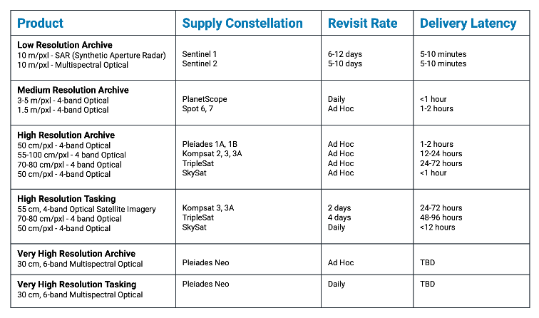
This chart includes a high-level overview of each available product.