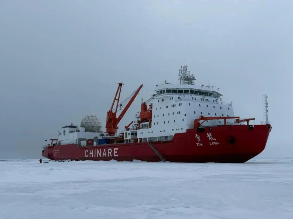
China’s icebreaker Xuelong successfully received and processed data from the HY-1E ocean-color satellite while sailing at high speed in the Arctic on Aug. 27, marking the first time the vessel’s shipborne satellite remote sensing system has acquired and processed data from the new-generation satellite in the region.
The system maintained stable tracking of the HY-1E signal and received data of sufficient quality to generate 5-meter-resolution panchromatic imagery and 20-meter-resolution multispectral products from the satellite’s coastal zone imager.
The operation validated the feasibility of using a mobile receiving station to acquire point-beam remote sensing data from a fast-moving vessel. It also adds a new high-resolution optical data source to the real-time satellite remote sensing services supporting China’s polar expeditions.
HY-1E test challenges shipborne tracking capability
HY-1E is the world’s first ocean color observation satellite equipped with multiple optical satellite payloads to conduct high-precision detection of various water bodies across the globe. Its payloads are designed to provide optical observations that can support marine and coastal environmental monitoring, water-body assessment and other Earth observation applications.
The satellite uses a dual-channel point-beam system to transmit data to the ground at high rates. Such a downlink places greater demands on a shipborne receiving station than a conventional fixed ground station. The antenna must rapidly acquire the satellite, maintain accurate pointing and compensate for the vessel’s changing position, heading, speed and attitude during the transmission window.
A point-beam downlink also makes mission planning and timing particularly important. If the vessel moves outside the expected access geometry, the receiving system may lose the satellite link before the data transmission is completed.
To prepare for the operation, the satellite remote sensing route-support team maintained close communication with the Xuelong crew. Operational personnel at the National Satellite Ocean Application Service developed a HY-1E transmission plan based on the vessel’s estimated position. The route-support team then used the transmission time window to calculate the ship’s position more precisely and uploaded the relevant position information to the satellite platform.
On Aug. 27, the shipborne system successfully captured the HY-1E signal during the vessel’s high-speed Arctic voyage and maintained stable tracking. It subsequently received the satellite data and generated the 5-meter panchromatic and 20-meter multispectral products.

5-meter panchromatic imagery from the Coastal Zone Imager
Optical data adds detail to polar route support
The newly generated products give polar expedition teams access to another source of high-resolution optical imagery during their voyages. Panchromatic imagery can provide finer spatial detail for identifying boundaries and surface features, while multispectral imagery adds spectral information that can help distinguish water, ice and other surface conditions under suitable observation conditions.
For ice-area navigation, satellite imagery is generally used together with shipborne radar, visual observations, meteorological information and other navigation data. Its principal advantage is its ability to provide a wider-area view of sea-ice and surrounding environmental conditions than observations made from the vessel alone.
Operational value will depend on several factors, including cloud cover, illumination, satellite access geometry, the timing of data reception and the speed at which the products can be processed and delivered to navigators. Bringing reception and processing capabilities aboard the vessel can reduce the delay between satellite observation and operational use, which is particularly important when ice conditions change rapidly.
A multi-satellite system aboard Xuelong
The shipborne satellite remote sensing system is installed aboard Xuelong to receive and process remote sensing data in real time during polar scientific expeditions. It can receive and process data from remote sensing satellites such as the China Ocean Satellite series (HY-1C/1D/1E) and the Gaofen-3 satellite series (GF-3/CSAR01/CSAR02) in real time, so as to realize route support during polar expeditions.
The combination of optical and synthetic aperture radar data provides complementary coverage. Optical imagery can offer detailed visual and multispectral information when lighting and weather conditions are favorable. SAR imagery can operate through cloud cover and in darkness, making it useful when optical observations are unavailable or limited.
The system was completed and placed into operation in 2015. Since then, it has accompanied Xuelong on multiple Chinese polar scientific expeditions and supplied real-time satellite remote sensing products for route support, including assistance with navigation in ice-covered waters.
The successful HY-1E operation extends the system’s satellite data portfolio and demonstrates that a shipborne mobile receiving station can handle high-rate point-beam transmissions while operating on a fast-moving vessel. It also shows that satellite tasking, vessel-position prediction, onboard reception and product generation must operate as one coordinated chain for satellite data to become useful in time-critical polar operations.
Broader access to satellite data and payload capacity
As China expands its satellite manufacturing and Earth observation capacity, international users are gaining access to a wider range of satellite imagery and payload solutions at increasingly competitive prices. The most cost-effective option, however, depends on the application: a maritime monitoring task, for example, may not require the same spatial resolution or spectral capability as a detailed infrastructure or coastal survey.
STARPATH GLOBAL’s satellite imagery services help users select suitable data sources and resolutions according to their specific industry requirements, providing the level of detail needed without paying for unnecessary capability. Organizations that lack in-house remote sensing experience can also apply for the Pioneer Partner Program, through which STARPATH GLOBAL’s Forward Deployed Engineers help identify practical use cases and assess whether satellite remote sensing can deliver measurable operational value.