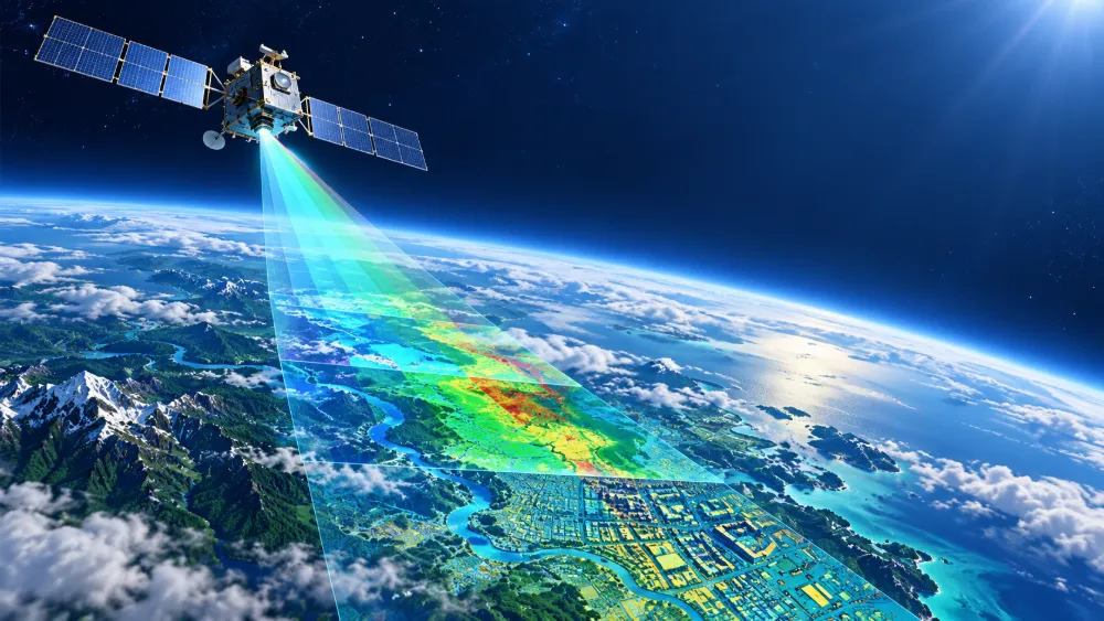
In early July, Academician Zhang Bing and his co-authors published an article in the Journal of Remote Sensing, summarizing and discussing 10 frontier scientific questions in remote sensing science and technology.
Original article: https://www.ygxb.ac.cn/zh/article/doi/10.11834/jrs.20266221/
Abstract
Remote sensing is a fundamental technology for understanding the Earth system. The integration of coordinated satellite-airborne-tower-ground observations with artificial intelligence, big data, digital twins and other emerging technologies is transforming remote sensing from static, single-sphere and morphology-oriented observation toward integrated observation that combines dynamic monitoring, cross-sphere analysis, process retrieval and three-dimensional probing. This transition is accelerating the shift of Earth science toward a data-driven paradigm of quantitative analysis.
The article identifies 10 frontier scientific questions arising from this disciplinary transformation, which can be grouped into three categories.
The first category focuses on theory and modeling, including multidimensional radiative transfer mechanisms, remote sensing foundation models and agents, and tomographic probing of polar ice sheets. These topics center on unified modeling that integrates physical mechanisms with artificial intelligence.
The second category covers observation technologies, including coordinated observation by virtual satellite constellations, real-time multimodal processing and natural disaster monitoring and early warning. The emphasis is on improving multi-platform coordination and intelligent processing capabilities.
The third category concerns system-level applications, including carbon-water-energy cycles, habitable planet exploration, human-Earth system integration and the impacts of climate change. These questions are intended to support major scientific and societal needs.
Together, the three categories point toward deeper integration between remote sensing and AI, greater coordination of multisource data, and an upgrade from an “observation-to-analysis” paradigm toward an “observation-to-decision” paradigm. Their priorities differ: theoretical questions emphasize fundamental breakthroughs, technological questions focus on system implementation, and application questions stress interdisciplinary deployment.
Overall, the field is moving from experience-driven methods toward a combination of physical mechanisms and data-driven approaches, and from static monitoring toward dynamic prediction and intelligent decision-making. Future advances will require stronger interdisciplinary collaboration, open research platforms and international cooperation to address major challenges including climate change, natural disasters, ecological degradation and deep-space exploration.
01 Unified Modeling of Multidimensional Remote-Sensing Radiative Transfer Mechanisms and Scientific Understanding
The rapid development of multidimensional remote sensing observations — across scales, spectral bands, viewing angles and time — together with advances in artificial intelligence is creating new opportunities for Earth system science.
“Unified modeling of multidimensional remote-sensing radiative transfer mechanisms and scientific understanding” represents a foundational scientific question for quantitative remote sensing across different Earth system spheres and spatial scales. It underpins forward simulation, quantitative retrieval and scientific interpretation.
Its central challenges include developing mathematically unified descriptions of complex land surfaces, such as heterogeneous vegetation, rough surfaces, mixed pixels and mountainous terrain; resolving multidimensional radiative transfer and scattering mechanisms for both active and passive remote sensing; establishing unified quantitative models for multidimensional active and passive observations; simulating coupled Earth-system remote sensing imagery; developing physics-constrained AI foundation models for multidimensional quantitative remote sensing; and creating robust methods for solving ultra-high-dimensional ill-posed inverse problems.
Progress in this field could deepen the integration of quantitative remote-sensing physics and artificial intelligence and give rise to a new generation of physics-guided AI modeling. It could also support intelligent retrieval models that are both physically interpretable and highly generalizable, while improving multiscale numerical simulation and scientific understanding across the Earth system.
02 Intelligent Extraction of Remote-Sensing Information on Material and Energy Cycles in the Earth Surface System
Carbon, water and energy cycles are among the most fundamental processes governing exchanges of matter and energy in the Earth surface system. They have profound implications for global climate, ecosystems and food security and are critical to achieving global carbon-emission reduction targets.
Remote sensing is currently the only technology capable of providing large-area, long-term monitoring of these processes. However, existing remote-sensing approaches to carbon-water-energy cycles face three major challenges.
First, the ability to jointly retrieve coupled carbon, water and energy fluxes remains limited, while retrieval of individual parameters alone is often insufficient to support major discoveries in Earth science.
Second, current systems lack adequate intelligence to efficiently coordinate and integrate multisource satellite-airborne-ground observations, resulting in poor spatial and temporal consistency and high uncertainty in derived products.
Third, applications at the user end remain disconnected from upstream data production. Global thematic products generated at predetermined resolutions cannot fully accommodate diverse user requirements, potentially wasting both storage and computing resources.
These challenges arise from a fundamental mismatch between the instantaneous observations produced by remote sensing and the continuous processes operating within the Earth system.
For this reason, intelligent extraction of remote-sensing information for carbon-water-energy cycles is considered a major scientific priority.
From the perspective of disciplinary development, it could shift remote-sensing retrieval from an experience-driven approach toward a mechanism-plus-data dual-driven model, while making the technology more intelligent and precise.
For industry and practical applications, it could provide critical technical support for ecosystem health assessment, water-resource management, climate prediction and carbon-sink accounting, contributing to global climate governance and ecological sustainability.
03 Theory and Methods for Coordinated Observation by Virtual Remote-Sensing Satellite Constellations
Earth observation is evolving from the independent operation of individual satellites toward a new paradigm of intelligent multi-satellite coordination.
However, satellites currently in orbit around the world remain physically dispersed, technologically heterogeneous and governed by different standards. Multisource observations from spaceborne, airborne and ground-based platforms also differ inherently in radiometric references, geometric accuracy, spatial and temporal scales, and spectral response.
These differences significantly constrain data fusion and coordinated analysis. Traditional approaches based on “post-launch validation” and “post-acquisition data processing” can no longer meet the requirements of highly accurate, consistent and timely global dynamic monitoring.
The theory and methods for coordinated observation by virtual remote-sensing satellite constellations are intended to overcome these limitations.
One key approach is to build end-to-end digital twin models spanning the surface, atmosphere, payloads and data-processing chain. Such models could provide high-fidelity simulations and quantitative assessments of the radiometric and geometric responses of different platforms and payload types under complex observing conditions.
This would fundamentally improve the predictability of virtual-constellation performance as well as the physical consistency and interoperability of multisource data.
At the same time, researchers could establish ground-based validation systems and joint multi-satellite calibration frameworks. Highly accurate ground calibration and validation data could serve as benchmark inputs and verification references for digital twin models, enabling iterative optimization and creating a closed-loop mechanism linking simulation design, real-world observation, performance evaluation and model optimization.
An optimized digital twin system could not only improve the overall observing efficiency of a virtual constellation but also guide the scientific layout and coordination strategies of ground observation networks, enabling two-way reinforcement between space-based and ground-based systems.
On this basis, researchers could establish unified discrete global grids and multiscale representation frameworks, formulate technical standards for coordinated virtual-constellation observations, and develop hybrid research approaches that combine physical mechanisms with data-driven methods.
This could accelerate the transition of Earth observation from conventional data acquisition toward intelligent mission planning and precise information extraction, providing key scientific support for global virtual Earth-observation constellations and driving remote sensing from fragmented observation toward systematic, coordinated sensing.
04 Quantitative Retrieval of Key Geoscience Parameters Driven by Remote-Sensing Foundation Models and AI Agents
As Earth observation enters the era of big data, deeper integration between artificial intelligence and remote sensing is moving geoscience research beyond traditional physics-model-driven approaches toward combined data- and knowledge-driven methods.
For quantitative retrieval of key geoscience parameters such as vegetation productivity, land-surface temperature and carbon fluxes, conventional methods have long faced difficulties in integrating multisource data, generalizing across broad spatial and temporal ranges, and adequately incorporating physical mechanisms.
Remote-sensing foundation models, pretrained on large-scale multimodal datasets, can establish unified spatial and temporal representations and enable feature transfer across sensors, regions and time periods. This can significantly improve the accuracy and robustness of parameter retrieval under complex land-surface conditions.
Building on these models, remote-sensing AI agents can integrate perception, reasoning and decision-making capabilities, transforming remote sensing from passive data processing into active task solving.
Such agents could independently interpret scientific objectives, automatically organize retrieval workflows according to geophysical constraints, dynamically call specialized model libraries and toolchains, and produce scientific interpretations consistent with expert knowledge.
The result is a closed loop linking observation, retrieval and scientific understanding.
The combination of foundation models and agents could not only accelerate the automation of geoscience parameter extraction but also address the lack of interpretability associated with conventional “black-box” deep-learning models by incorporating physical constraints and expert knowledge.
This could move quantitative retrieval from pure data fitting toward a physics-and-data dual-driven paradigm.
Future research will need to address several critical technologies, including consistent representation of heterogeneous multisource data, high-precision physical feedback mechanisms and autonomous decision-making logic for intelligent agents.
Open retrieval benchmarks and training and evaluation platforms could further promote the use of foundation models and AI agents in complex geoscience scenarios including land-surface process simulation, climate-change monitoring and disaster prevention and mitigation, ultimately shifting the field from expert-experience-based retrieval to autonomous AI-agent assessment.
05 Real-Time Intelligent Processing of Multimodal Remote-Sensing Data
As Earth-observation capabilities continue to improve, remote-sensing data acquisition has entered an era characterized by multiple platforms, multiple sensors and high spatial and temporal resolution, with observations increasingly moving toward high-frequency updates and near-real-time availability.
Yet a significant gap remains between data acquisition and real-world applications.
The scale, diversity and complexity of remote-sensing data often make it difficult to convert raw observations directly into actionable operational knowledge. Weaknesses are particularly evident in real-time response and cross-modal collaborative processing, limiting the value of remote-sensing data in agriculture, disaster management, urban development, ecology and other important fields.
In recent years, remote-sensing foundation models represented by AlphaEarth Foundations (AEF) have accelerated the transition toward AI-ready data. Unified embedding representations can lower barriers to using massive amounts of multisource remote-sensing data and provide infrastructure for large-scale intelligent analysis.
However, existing model systems are still largely designed for offline analysis. They remain limited in real-time processing, dynamic multimodal coordination and rapid task-oriented inference, making them difficult to deploy for immediate decision-making in complex operational scenarios.
The field therefore needs a full-chain intelligent remote-sensing processing system capable of multimodal fusion and real-time response for specific applications.
Such a system should integrate multisource collaborative modeling, real-time processing mechanisms and intelligent reasoning with remote-sensing physics, domain knowledge and user intent.
The goal is to establish a closed processing loop from real-time multimodal sensing and dynamic understanding to intelligent decision-making, moving remote-sensing intelligence from offline analysis toward real-time intelligent services.
This could provide essential technological support for highly responsive, trustworthy and scalable intelligent remote-sensing applications.
06 Remote Sensing for Habitable Planets and Habitable Environments
The search for habitable planets and the study of habitable-environment evolution are major scientific objectives in international planetary science and deep-space exploration. They are also relevant to fundamental questions about the origin of life on Earth and the evolution of the universe.
Around 2028, the United States’ Artemis program is expected to advance crewed lunar exploration, while a European Space Agency Mars lander mission is expected to target the Martian surface.
China also plans to carry out the Tianwen-3 Mars sample-return mission around 2028. Searching for signs of life is its primary scientific objective, with key questions including where to go, what to sample and how to collect it.
Coordinated multisource remote-sensing methods — including visible-light, infrared, microwave, laser and neutron observations — could enable high-precision exploration of the surfaces and other layers of planets and moons across the Solar System at both regional and in-situ scales.
These observations could provide essential technical support for characterizing key indicators of planetary habitability, including morphology and geological structure, material composition, atmospheric environment, physical fields and internal structure.
New remote-sensing technologies and AI foundation models could further enhance the search for habitable planets and the selection of potentially habitable regions.
They could also enable a new research paradigm for systematically comparing habitable environments on Earth with those on other worlds, creating new insights into planetary habitability, the evolution of habitable environments, and the origin and preservation of life.
07 Multimodal Fusion of Remote-Sensing and Social-Sensing Data for Understanding Coupled Human-Earth Systems
Human-Earth systems are highly complex systems in which the natural environment and socioeconomic activities interact and influence one another. Understanding these coupled processes is essential for sustainable human development.
A systematic understanding of human-Earth coupling increasingly depends on an Earth-system science framework that coordinates information across different spheres.
This requires integrating conventional Earth observation, which monitors natural characteristics through remote sensing, with observations of human activity derived from nighttime-light remote sensing, social sensing and other remote-sensing and non-remote-sensing multimodal datasets.
Social-sensing data — such as social-media activity, mobile-phone signaling records and vehicle trajectories — directly characterize the spatial and temporal patterns of human activity.
These datasets strongly complement remote-sensing information describing the natural state of the land surface, together enabling multidimensional analysis of interactions between nature and society.
Comprehensive and fine-grained observation of socioeconomic activity is also an important foundation for building highly realistic digital twin environments and supporting spatial-temporal simulation and optimized decision-making.
However, the field continues to face major theoretical and technical challenges.
First, socioeconomic systems exhibit highly dynamic, non-stationary and heavy-tailed statistical characteristics, while observational data also contain substantial uncertainty. Conventional remote-sensing fusion theories based primarily on spectral physics cannot be directly applied, creating an urgent need for new theoretical frameworks capable of unified cross-modal fusion.
Second, multisource datasets differ in spatial and temporal reference systems, granularity and semantic levels, making reliable spatial-temporal alignment, uncertainty quantification and semantic association difficult.
Generalizable methods are still lacking for extracting robust geographic features from heterogeneous data and achieving interpretable fusion.
Another fundamental challenge is determining how coupled models can reveal nonlinear and bidirectional interactions between natural and socioeconomic systems.
Innovating theories for fusing remote-sensing and non-remote-sensing multimodal data, overcoming challenges in spatial-temporal-semantic coordination, uncertainty propagation and interpretation of complex mechanisms, and systematically revealing coupled human-Earth processes have therefore become major frontier questions in remote-sensing science.
Solving these challenges could enable large-scale, long-term and fine-grained dynamic studies of human-Earth systems and provide critical scientific support for sustainable development.
08 Remote-Sensing Tomography of Multiscale Physical Processes in Polar Ice Sheets
Accurately predicting the future rate of sea-level rise is one of the most urgent scientific challenges today.
If the polar ice sheets were to melt completely, global mean sea level would rise by about 70 meters.
Polar ice-sheet systems may be approaching critical thresholds. Atmospheric warming is accelerating mass loss from the Greenland Ice Sheet, potentially pushing it toward an irreversible stage of sustained mass deficit. Meanwhile, ocean warming is accelerating basal melting beneath ice shelves in West Antarctica, potentially triggering instability at the base of the ice sheet and abrupt collapse.
Large interconnected subglacial hydrological systems also exist beneath ice sheets, and their drainage processes can lead to rapid ice-sheet sliding.
Hydraulic fracturing caused by meltwater at the ice surface can further expand crevasses and may even trigger rapid ice-sheet disintegration, accelerating the movement of inland ice into the ocean.
These processes occurring within and beneath ice sheets are extremely complex and represent one of the largest gaps in scientific understanding needed to predict future ice-sheet change.
Key questions include: How are hydrological systems distributed within ice sheets? How do deep water and continental-shelf water regulate basal melting beneath ice shelves? How do hydrological processes beneath ice sheets affect their stability?
Conventional remote-sensing methods generally provide only two-dimensional imagery and cannot resolve internal layering.
Airborne and ground-based ice-penetrating radar can provide high-resolution “slices” through ice sheets, but it cannot yet deliver large-scale tomographic observations.
The essence of seeing through ice sheets with remote sensing is to use electromagnetic waves, gravitational fields or other signals capable of penetrating a medium and detecting responses from internal structures or interfaces.
Yet this approach faces fundamental challenges, including the trade-off between penetration depth and resolution, the complexity of signal interpretation and limitations in observation scale.
Developing dynamic three-dimensional ice-sheet models capable of predicting future changes is therefore a frontier scientific challenge combining advanced technology, major scientific demand and deep interdisciplinary integration.
It represents a critical area in addressing the climate crisis and offers significant potential for future exploration.
09 Real-Time Remote-Sensing Monitoring and Early Warning of Global Natural Disasters
The interaction of natural disasters with climate change and human activities is increasing the complexity and extremity of disasters worldwide while adding uncertainty to disaster risks, creating major challenges for sustainable human development.
Rapid advances in satellite remote sensing and artificial intelligence are increasingly converging, creating new opportunities for real-time global disaster monitoring and early warning.
A central scientific and technological challenge is how to intelligently apply rapidly expanding volumes of multimodal remote-sensing data to disaster forecasting and early warning, risk prevention and emergency response, while ultimately improving human safety.
Based on theories of remote-sensing ontological cognition, researchers could hierarchically analyze disaster risk factors and their remote-sensing response characteristics, express them through structured knowledge graphs, and model their relationships.
This could deepen understanding of how disasters develop and how risks evolve while improving scientific awareness of integrated disaster risk.
At the same time, the integration of remote sensing, communications and navigation into real-time, intelligent and proactive services could help address a range of technical challenges.
These include highly sensitive sensing under complex and extreme conditions, real-time remote-sensing detection of abnormal surface changes, intelligent interpretation of remote-sensing big data and proactive risk assessment, precise early warning and prevention, and targeted emergency rescue.
The goal is to establish intelligent models linking sensing, cognition and decision-making for disaster prediction and situation assessment, creating global, all-time and comprehensive remote-sensing information services.
Such capabilities could improve the precision of natural-disaster warnings, support more refined integrated-risk prevention and strengthen real-time emergency-response decision-making, contributing to global disaster-risk reduction and broader international security initiatives.
10 Remote-Sensing Prediction of the Impacts of Global Climate Change on Regional Ecosystems
Against the backdrop of global climate change and rapid socioeconomic development, ecosystems are facing multiple pressures, including biodiversity loss, degradation of ecosystem functions and declining resilience.
Traditional ground surveys are constrained in both spatial and temporal coverage, limiting scientific understanding of how global change affects regional ecosystems.
Remote sensing provides an important means of ecosystem monitoring, but two major bottlenecks remain.
First, there is a lack of remote-sensing-driven core indicators for monitoring ecosystem functions and resilience, making it difficult to quantify and predict ecosystem responses to global change.
Second, multiscale coordinated remote-sensing products for biodiversity and environmental-health risks remain insufficient, limiting precise and operational applications.
Future research could integrate multisource data from ground, near-surface and satellite observations with environmental DNA and other emerging datasets.
By deeply combining artificial intelligence with ecological theory, researchers could establish comprehensive biodiversity remote-sensing frameworks spanning individuals, populations, communities and entire ecosystems.
They could also develop multidimensional indicator systems covering species diversity, functional diversity, phylogenetic diversity and ecosystem resilience, together with dynamic early-warning models capable of identifying ecological disturbances and critical tipping points.
This could enable a transition from static assessment to dynamic early warning, providing a scientific basis for assessing and predicting ecosystem responses to global change.
At the same time, advances are needed in high-precision retrieval of key parameters describing interactions among pathogens, hosts and habitats.
These capabilities could help reveal links between ecological change and risks to human health, support the construction of coupled environment-ecology-health digital twin systems, and establish operational closed loops connecting sensing, analysis, early warning and feedback.
Such systems could provide scientific support for ecosystem management and public-health protection in a changing global environment.
Related Reading: Top 10 Frontier Questions in Remote Sensing Unveiled by Chinese Academy of Sciences Institute