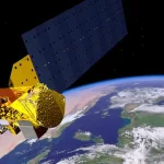
Satellite thermal intelligence converts temperature measurements collected from orbit into actionable information. Its primary input is thermal-infrared imagery, which records emitted heat instead of reflected visible light. After processing and analysis, this data can reveal when a refinery resumed operations, whether an agricultural field may require irrigation, how a wildfire is spreading or which buildings are losing heat through their roofs.
A thermal image is essentially a grid of measured radiance or temperature values. It becomes intelligence only after the data has been calibrated, compared with historical observations, combined with optical or radar imagery and converted into a usable output.
How does Thermal Imaging Works?
Every object with a temperature above absolute zero emits electromagnetic radiation. Objects at typical environmental temperatures radiate primarily in the infrared portion of the spectrum rather than at visible wavelengths. A wall, a person, an area of soil and a cup of tea all continuously emit infrared energy. As an object becomes hotter, it radiates more energy and its peak emission shifts toward shorter wavelengths.
This relationship is described by Wien’s displacement law, one of the fundamental principles behind thermal remote sensing. The peak wavelength can be estimated by dividing 2,898 by the object’s temperature in kelvin:
- Ordinary ground at approximately 300 K, or 27°C, peaks near 9.7 µm.
- An active wildfire at approximately 800 K peaks near 3.6 µm.
- A gas flare or blast furnace at approximately 1,200 K peaks near 2.4 µm.
These differences explain why thermal satellites use different spectral bands for different applications. Sensors intended to measure land-surface temperature generally operate in the long-wave infrared region from 8 to 14 µm, where surfaces at ordinary terrestrial temperatures emit strongly. Instruments designed to detect wildfires, gas flares and industrial heat sources typically use the mid-wave infrared region from 3 to 5 µm, where high-temperature targets are easier to distinguish from their cooler surroundings.

Emission curves for four temperatures
Key Applications of Satellite Thermal Intelligence –
Wildfire Detection: The key measurement is fire radiative power – the radiant heat output of a fire in megawatts, derived from the excess brightness in a mid-wave channel over the surrounding background. Integrated over time it estimates how much biomass has actually burned, which is more direct than inferring it from burned area. Commercial operators compete on latency: minutes from observation to alert, with some now doing the detection on board before downlink.
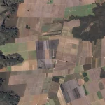
Crop Water Stress and Irrigation: A well-watered plant transpires and cools itself; a stressed plant closes its stomata and heats up. Thermal imagery therefore reveals water stress days before the plant looks any different in visible or near-infrared light. NASA’s OpenET platform computes field-scale evapotranspiration primarily from Landsat thermal data at roughly quarter-acre resolution, validated against 152 ground stations to within 10-20% and Californian water authorities now use it for statutory water-use reporting.
Industrial Activity monitoring: A refinery, steel mill, power station or data centre has a thermal signature that changes when it is running, throttled back or shut down.
Emissions and Flaring: At higher resolution, thermal is being paired with atmospheric CO₂ measurements to estimate facility-level emissions independently of self-reporting.
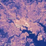
Urban heat and building efficiency. City authorities use thermal imagery to map heat islands and target tree planting and cooling. At 3.5 m resolution the same data can identify individual buildings losing heat through their roofs.
Defence and Security. Thermal has moved decisively into this domain. The US Space Development Agency awarded around $3.5 Billion in December 2025 for 72 satellites carrying infrared missile-warning and tracking sensors, and commercial thermal firms increasingly market “activity intelligence” to defence customers.