Think of a satellite as a courier collecting packages. But what happens after collection? Between a satellite pressing its “shutter” and a wildfire alert, flood map or vessel track appearing on your phone, how many steps does the data go through? Let’s unpack the entire data pipeline.
The Traditional Pipeline: Shipping Every Ingredient Back to Earth
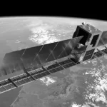
A traditional remote-sensing satellite works like a central kitchen that ships all its fresh ingredients back to headquarters through a refrigerated supply chain. The satellite records raw imagery in orbit, then waits for a brief ground-station contact window to transmit large volumes of data. Only afterward does a ground-based data center begin “washing, chopping and cooking”: radiometric correction, geometric correction and image interpretation. Every stage still has to be completed.
This pipeline has two major bottlenecks. First, transmission capacity is limited. According to a September 2026 report in Guangming Daily, constraints on ground-station resources and transmission bandwidth mean that less than one-tenth of satellite data can be returned to Earth. In the situation described by the report, more than 90% of the data collected remains in orbit rather than reaching users. Second, the processing chain is long. Once the data reaches the ground, it still has to be ingested, archived, distributed and interpreted. Moving from “the satellite captured it” to “the user knows about it” can take hours or longer.
For emergency response, those hours can make a life-or-death difference. This is the problem space-based computing aims to address.
Jargon Explained: Downlink
Downlink is the transmission of data from a satellite to Earth. In a direct satellite-to-ground link, transmission requires the satellite to be within a ground station’s line of sight, leaving a limited number of contact windows each day. Think of a courier who can return to the depot only two or three times a day, with just a few minutes to unload each time. In plain language: there is enormous data-generating capacity in orbit, but a narrow delivery channel to the ground.
The New Pipeline: Move the Kitchen Into Orbit
Space-based computing moves the “central kitchen” into orbit: process the data aboard the satellite and send the finished dishes back to Earth.
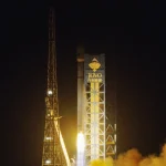
Two recent missions illustrate this approach. On September 20, 2026, the S-AIDC-1 computing satellite entered orbit as part of a project described as China’s first integrated computing-satellite initiative combining a company’s first satellite with an exclusively branded launch vehicle. It is designed to analyze imagery, filter data and generate assessments directly in orbit. Instead of routinely downlinking raw imagery, it transmits the most valuable information, reducing response times across the space-to-ground data chain from hours to minutes, according to Science and Technology Daily on September 23, 2026.
PEGA-SUS1, launched on the same day, takes integration a step further. The 150-kilogram satellite combines a 5G base station, a core network, satellite-to-ground laser communications and an AI computing payload. A GalaxySpace engineer offered a practical example: after the satellite captures remote-sensing imagery, its onboard AI detects and identifies fire targets, produces a fire assessment, estimates the affected area and quickly transmits the results, without first sending the raw imagery to Earth. Ground users connect to the satellite network through Ka-band terminals and access the satellite’s analysis “as easily as browsing a webpage,” according to China Securities Journal on September 20, 2026.
One detail matters: the system also supports on-demand retrieval of raw imagery. The finished dish arrives first; if users want to inspect the ingredients, those can follow. That flexibility is one of the new pipeline’s smartest features.
Jargon Explained: Onboard AI Inference
AI involves two distinct steps: training and inference. Training is like a student attending classes: it requires substantial computing resources and generally takes place on the ground. Inference is like the student answering questions using what they have learned: it typically requires fewer resources and can run aboard a satellite. The prevailing approach is therefore “inference in orbit, training on the ground.” In plain language: the satellite answers the questions; it does not write the textbook.
Who Receives the Intelligence?
The customers at the end of this pipeline are more familiar than many people might expect. S-AIDC-1’s announced service areas include disaster response, such as rapidly mapping collapsed buildings after an earthquake; natural-resource management, including monitoring changes in farmland; environmental monitoring, such as identifying discharge outlets; and marine-resource exploration, including analysis of vessel movements. Tasks that previously required expert teams to spend hours interpreting imagery are increasingly being targeted for automated analysis in orbit.
Huafu Securities offers a broader industry assessment: space-based computing is moving beyond technology validation and policy support toward the threshold of large-scale deployment. Intelligence aboard individual satellites already has established applications, while processing space-generated data in space is moving toward commercialization. This data pipeline gives that idea a concrete form.
Key Figures
1. Less than one-tenth of satellite data is downlinked in the situation described by Guangming Daily on September 24, 2026.
2. S-AIDC-1’s onboard processing is designed to reduce response times from hours to minutes, according to Science and Technology Daily on September 23, 2026.
3. PEGA-SUS1 carries a 100 Gbps satellite-to-ground laser communications payload, according to China Securities Journal on September 20, 2026.
A Question Worth Considering
If onboard computing resources are limited, could filtering data in orbit discard unexpected information whose value becomes apparent only later? Some breakthroughs in earthquake research have come from data that nobody initially thought to examine. If satellites deliver only finished dishes, could we miss discoveries that were never on the menu? Share your thoughts in the comments.
One Sentence to Remember
Space-based computing changes how quickly results reach you, rather than how sharply a satellite sees.
For organizations putting satellite data to work, the practical challenge is connecting suitable imagery, reliable analysis and everyday decisions. STARPATH GLOBAL draws on China’s expanding satellite capacity to provide competitively priced imagery and help customers choose resolutions suited to their monitoring needs. To develop a workflow for forestry, agriculture, mining or infrastructure, discuss your requirements with STARPATH GLOBAL; teams building their remote-sensing capabilities can also apply to the Pioneer Partner Program for support from our Forward Deployed Engineers.