AI super-resolution can make satellite imagery look sharper and, in some validated workflows, improve the information extracted from it. But it does not automatically turn a low-resolution observation into the equivalent of a native high-resolution image. Whether it can replace a new imagery purchase depends on the task: a background map, a land-cover classification, a building boundary measurement and a vehicle count require different evidence.
The practical question is therefore not how far an image can be enlarged. It is whether the enhanced product supports the decision you need to make, with an acceptable and independently measured error.
Why a Sharper Image Can Be Misleading
Enhancing 10-meter Sentinel-2 imagery to an output grid finer than 4 meters offers an appealing prospect: recent, widely available observations with clearer-looking buildings, roads, field boundaries and water edges. For GIS platforms and monitoring services, that could improve presentation and help users interpret a scene.
However, improving visibility and recovering reliable detail are different objectives. An enhancement method must also preserve geographic alignment and, where relevant, spectral information. This becomes particularly important when users want to measure building boundaries, identify localized damage or distinguish small objects.
Models such as SEN2SR and deep learning image-enhancement workflows provide starting points for evaluation. Their availability does not establish that their outputs can replace finer observations for a particular task. That requires comparison with the original imagery and independent reference data.
The distinction matters because an image can become easier to interpret without every new edge, roof texture or tree-like shape being correct. A convincing appearance is a property of the output. The existence, position and dimensions of a real object require independent evidence.
Five Processes Often Called “Enhancement”
Before evaluating a product, establish what processing has actually been applied. Several techniques can produce a sharper-looking image, but they draw on different information.
Resampling
Resampling places existing image values onto a different pixel grid. Nearest-neighbor, bilinear and cubic methods are common examples. A 10-meter image can be exported with 2.5-meter pixels, but the smaller grid does not provide new independent observations of the ground.
Resampling is useful for display, reprojection and matching datasets to a common grid. It should not be described as acquiring finer spatial detail.
Sharpening
Sharpening increases edge contrast or attempts to compensate for blur. It can make roads, field boundaries and large structures easier to see. Depending on the method, it can also amplify noise or introduce halos and ringing around edges.
A more distinct edge is not necessarily a more accurately located edge.
Pansharpening
Pansharpening combines lower-resolution multispectral imagery with a finer-resolution panchromatic observation. It incorporates spatial information measured by another band.
However, the resulting color image does not mean that every multispectral band was independently observed at the panchromatic resolution. Spectral distortion and alignment errors still need assessment. Sentinel-2 has bands at 10, 20 and 60 meters, but no dedicated panchromatic band; enhancing its coarser bands with its finer bands is a different problem from conventional pansharpening.
Single-Image Super-Resolution
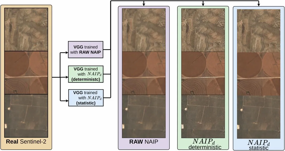
Single-image super-resolution estimates a finer image from one input image. AI methods use patterns learned during training to infer likely structures and textures. Some emphasize numerical fidelity; others emphasize a realistic visual appearance. Those objectives can produce different results.
The input constrains the estimate, but it may not uniquely determine the fine detail. Several different arrangements of small objects could produce a similar low-resolution observation. A model can choose a plausible arrangement without establishing that it is the arrangement on the ground.
Multi-Image and Multi-Temporal Super-Resolution
Multi-image methods combine several observations of the same location. Small differences in sampling position can supply complementary information, allowing reconstruction beyond what one image alone supports.
Satellite revisits also introduce complications. Buildings may be constructed, vehicles may move, vegetation may change and shadows may shift between acquisitions. Registration errors, clouds and atmospheric differences can interfere with reconstruction. A method must handle these differences rather than assume that every input shows an unchanged scene.
Products may also use an older high-resolution image as a guide. If so, buyers should ask how the method prevents historical structures from being carried into a supposedly current result.
Smaller Pixels Do Not Mean Equivalent Observations
Ground sampling distance describes the spacing of image samples on the ground. Effective spatial resolution concerns the detail that the imaging system and processing can distinguish. Positional accuracy concerns how closely mapped features match their actual locations. These are related, but separate, characteristics.
Consider a 10-meter image enhanced to a 2.5-meter output grid. Each original pixel footprint is represented by 16 output pixels. That is a fourfold increase in sampling density along each axis, not proof that the satellite observed 16 independent pieces of information within the original footprint.
A narrow, high-contrast feature may influence an original pixel even when it is smaller than that pixel. Super-resolution may help interpret that signal. But detecting an influence is different from recovering the feature’s exact width, shape or count.
For procurement, “2.5-meter output pixel size” should therefore be accompanied by the source sensor, native sampling, reconstruction method and validated performance. It should not stand alone as a claim of equivalence to native 2.5-meter imagery.
What Research Supports—and What It Does Not
There is evidence that super-resolution can provide analytical value. A study titled Multi-Spectral Multi-Image Super-Resolution of Sentinel-2 with Radiometric Consistency Losses and Its Effect on Building Delineation evaluated reconstructed imagery against higher-resolution references and assessed building delineation. Its results showed benefits from using multiple observations in the tested setting.
The MuS2 benchmark addresses another important issue: evaluating reconstruction with real Sentinel-2 observations and WorldView-2 reference imagery, rather than relying only on artificially downsampled images. Synthetic tests are useful, but they do not reproduce every difference between actual sensors and acquisition conditions.
The Asian Development Bank’s Beyond Pretty Pictures working paper presents SEN4X, which combines single-image and multi-image approaches and produces a 2.5-meter output grid. It reports that super-resolution can narrow the performance gap between Sentinel-2 and higher-resolution imagery.
These findings support testing super-resolution for specific applications. They do not establish that every model, region or target will benefit, or that an enhanced image is interchangeable with a finer native observation.
Validation Should Match the Task
A product accepted for presentation may fail a measurement requirement. Define the intended use before choosing either the enhancement method or the imagery source.
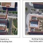
For building measurements, define whether the target is the visible roof outline or the ground footprint. Off-nadir imagery can displace roofs relative to the ground, even when the image is genuinely high resolution. AI enhancement does not remove that geometric problem.
For vehicle counts or other moving targets, an image acquired days later is generally unsuitable as an exact reference. For tree counts, distinguish visible crowns from actual stems. A sharper canopy texture does not establish the number of trees beneath it.
Build a Three-Way Comparison
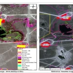
A useful evaluation shows the original observation, the enhanced output and an independent high-resolution reference over the same area. An original-versus-enhanced comparison alone demonstrates a visual change, not greater accuracy.
1. Choose Representative Test Areas
Include dense and sparse development, small and large targets, shadows, varied terrain and difficult boundaries. Keep evaluation locations separate from training and tuning areas. A model that performs well on familiar building layouts may behave differently in another region.
2. Check Dates and Geometry
Use references acquired as close as practical to the source observation. Record every input date for multi-temporal products and define the date or time window the output represents. Identify genuine changes between acquisitions before treating disagreements as reconstruction errors.
Align the datasets using stable features and assess residual registration error with independent checkpoints. Do not shift the reference to match each generated object, because that can conceal positional errors.
3. Display All Three Images at the Same Ground Scale
Use matching extents, scale bars and documented display settings. Label source sampling and output pixel size separately. Inspect ordinary areas as well as impressive examples, and include locations where the method fails.
4. Audit Objects, Not Just Texture
For each sampled target, check whether it exists in the reference, whether the enhanced image omits it, and whether its shape or position has changed. Record objects that have been invented, merged, split, duplicated or distorted.
If a reconstruction turns one blurred industrial roof into several crisp-looking rectangles, those rectangles are hypotheses until the independent reference confirms them.
5. Compare the Complete Analysis Workflow
Test the intended classifier, segmentation model or counting process using original imagery, a simple resampling baseline and super-resolved imagery. Where appropriate, compare these with a workflow using native high-resolution data.
Use the same independent evaluation labels and comparable training and tuning effort. Otherwise, an apparent benefit may come from unequal model preparation rather than the imagery enhancement.
Why Image Similarity Is Not Enough
Peak signal-to-noise ratio (PSNR) and structural similarity (SSIM) can help evaluate reconstruction when a suitable reference exists. Perceptual metrics can help assess visual resemblance. None directly establishes that a particular building corner is correctly located or that a vehicle count is accurate.
A high average image score can coexist with serious errors in small targets that occupy only a small part of the scene. A smooth output can score well while losing important edges; a visually striking output can introduce plausible but incorrect structures.
For multispectral products, spectral angle mapper (SAM) and ERGAS can complement PSNR and SSIM. SAM assesses differences in the direction of spectral vectors, while ERGAS summarizes relative reconstruction error across bands. Neither establishes whether an individual small object exists or whether its boundary is correctly positioned.
Cross-sensor comparisons also require attention to differences in spectral response, acquisition date and image alignment. An enhanced RGB visualization alone cannot demonstrate that the original multispectral measurements have been preserved.
Choose acceptance measures that reflect the application: class-specific precision and recall for classification, boundary errors in meters for measurement, object-level detection errors for counting, and false alarms and missed events for change monitoring.
If independent reference data are unavailable, improved identification or measurement accuracy remains unverified. Visual examples can demonstrate a change in presentation, but they should not be used to claim greater analytical accuracy.
When Native High-Resolution Imagery Is Still Needed
Native high-resolution imagery remains important when a decision depends on fine detail that the available inputs do not reliably constrain. Examples include measuring narrow structures, distinguishing adjacent small buildings, inspecting an early construction stage or counting individual objects.
It is also important when the observation must represent a specific moment. Combining multiple dates may help reconstruct stable features, but it can complicate questions about exactly when a structure appeared or how many vehicles were present.
For localized damage assessment, validation must cover the damage itself. A model that reconstructs intact buildings well may smooth away an unusual damaged roof or replace an unfamiliar pattern with a typical structure learned during training.
Even with native high-resolution data, resolution alone is not a complete purchasing specification. Acquisition date, cloud and shadow coverage, viewing angle, positional accuracy, spectral bands and processing level all affect whether the image can answer the question.
A practical approach is to use frequent, broad-area imagery to identify locations requiring attention, then obtain finer observations for confirmation. Super-resolution can contribute to that workflow if its role and limitations have been validated.
How to Present Enhanced Imagery to Clients
Make the distinction visible wherever users view or export the product. A suitable description might read: “AI-enhanced Sentinel-2 imagery; source sampling 10 meters; output pixel spacing 2.5 meters; fine features are reconstructed and require independent verification.”
Keep the original layer available, record the model version and input dates, and explain any use of historical reference imagery. For multi-temporal products, show the acquisition window rather than implying that every reconstructed feature was observed on one date.
Agreement between several AI models can help identify stable estimates, but it is not independent ground truth. Models can share training biases and produce the same wrong answer.
Choose the Data Around the Decision
AI super-resolution can be valuable when it improves a defined task under representative testing. It can reduce the need for finer imagery in some workflows, but a smaller output grid or a sharper appearance cannot establish that substitution on its own.
Before purchasing imagery or deploying enhancement, specify the smallest relevant target, the observation window, the required positional accuracy and the cost of a missed or false detection. Those requirements provide a firmer basis for selection than a visually impressive demonstration.
STARPATH GLOBAL helps customers select imagery around these requirements, matching resolution and acquisition conditions to the application and budget. Explore the Imagery Catalog for available data options, or discuss your monitoring task with STARPATH GLOBAL to assess where existing imagery may be sufficient and where native high-resolution observations are needed.