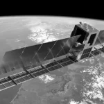
Researchers at Kyoto University have demonstrated a new way to observe Earth’s upper atmosphere by transforming publicly available Starlink orbital data into the first tomographic map of thermospheric density derived from real satellite measurements rather than simulations.
The study, published in *Earth, Planets and Space*, used orbital ephemeris data from approximately 1,200 Starlink satellites operating in a 482-kilometer orbital shell to reconstruct a two-dimensional latitude-longitude map of atmospheric density in the thermosphere, a region extending from roughly 100 to 1,000 kilometers above Earth. The work represents a significant step toward using commercial satellite constellations as large-scale scientific sensing networks.
Turning a Broadband Constellation into an Atmospheric Observatory
Accurate measurements of thermospheric density have become increasingly important as low Earth orbit (LEO) grows more congested with commercial satellites and orbital debris. Even at altitudes approaching 500 kilometers, residual atmospheric drag affects spacecraft trajectories, orbital lifetimes, conjunction assessments, and station-keeping requirements.
Led by Mamoru Yamamoto of Kyoto University’s Research Institute for Sustainable Humanosphere, the research team applied tomographic reconstruction techniques—commonly used in medical imaging—to orbital data generated by Starlink satellites. By analyzing orbital decay caused by atmospheric drag, researchers estimated the density of the surrounding neutral atmosphere across a large geographic area.
The resulting reconstruction produced a global density snapshot near the 500-kilometer altitude regime, offering a view of the thermosphere’s horizontal structure that has traditionally been difficult to obtain through direct observation.
Unlike the ionosphere, which can be monitored using radio-wave interactions because of its charged particles, the thermosphere consists of more than 99% electrically neutral gas, making large-scale measurements substantially more challenging.
Validation Against ESA’s Swarm Satellites
To assess the accuracy of the approach, the reconstructed density maps were compared with independent observations from the European Space Agency’s Swarm mission, which derives atmospheric density measurements along its orbital tracks.
According to the researchers, the Starlink-based reconstructions showed strong consistency with Swarm observations. Analysis of 19 reconstruction cases generated from data collected between September 1 and September 7, 2025, produced average density estimates that closely matched the independent satellite measurements.
The study also found that reconstructed density variations near peak atmospheric regions aligned well with both Swarm observations and the widely used NRLMSIS 2.1 atmospheric model, while in some low-density regions the Starlink-derived estimates tracked measured values more closely than the model predictions.
Commercial Constellations as Scientific Infrastructure
The research highlights a growing trend in which large commercial constellations generate datasets with value far beyond their original operational purpose.
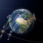
SpaceX publishes Starlink ephemeris information to support space traffic coordination and collision avoidance. Those datasets contain detailed orbital state information that can reveal subtle changes in satellite motion caused by atmospheric drag. By exploiting these measurements across hundreds or thousands of spacecraft simultaneously, researchers effectively gain access to a distributed sensor network spanning a substantial portion of low Earth orbit.
This approach differs from traditional atmospheric observation methods that rely on dedicated scientific spacecraft, sounding rockets, or sparse in-situ measurements. Instead, it leverages an existing operational fleet numbering in the thousands, potentially enabling far greater spatial coverage and temporal refresh rates.
The concept is particularly relevant as mega-constellations continue to expand. Future constellations operated by SpaceX, Amazon’s Project Kuiper, and other providers could collectively create unprecedented opportunities for continuous monitoring of the near-Earth environment.
Implications for Space Traffic Management
The ability to generate near-real-time thermospheric density maps could have practical implications for satellite operators and space traffic management organizations.
Atmospheric density directly influences orbital drag, which in turn affects conjunction predictions and reentry forecasts. During geomagnetic storms and other space weather events, thermospheric density can increase significantly, causing satellites to lose altitude more rapidly than expected.
Improved density measurements could enhance:
- Satellite orbit prediction accuracy
- Collision avoidance calculations
- Debris evolution modeling
- Space weather forecasting
- Mission planning for low Earth orbit spacecraft
The capability is particularly relevant given recent concerns about increasing conjunction rates among commercial constellations and the growing complexity of managing spacecraft operations in densely populated orbital regimes.
Engineering and Operational Significance
From a satellite operations perspective, the study demonstrates how constellation telemetry and orbital products can become secondary scientific assets without requiring additional onboard hardware.
Dedicated thermospheric research missions are costly and limited in coverage. By contrast, Starlink satellites already perform precise orbit determination and station-keeping operations necessary for broadband service delivery. The Kyoto University method effectively repurposes those operational datasets for atmospheric science.
The work also illustrates a broader shift occurring across the space sector, where large commercial infrastructures increasingly contribute to Earth observation, space situational awareness, and scientific research. Similar approaches may eventually be applied to other constellation datasets to monitor space weather effects, orbital debris environments, or changes in Earth’s upper atmosphere.
While the current study focused on a single Starlink shell near 482 kilometers altitude, future work could extend the technique across multiple orbital layers and larger datasets, potentially enabling more detailed three-dimensional monitoring of thermospheric structure and dynamics.