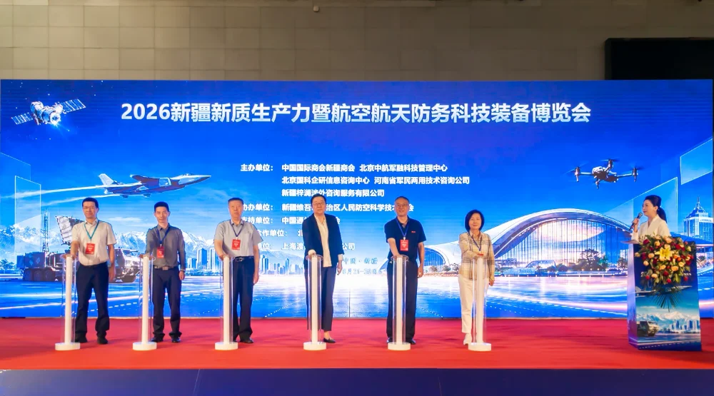
Urumqi, Xinjiang, China — The 2026 Xinjiang New Quality Productive Forces and Aerospace & Defense Technology Equipment Expo was held from August 21 to 23, 2026, at the Xinjiang International Convention and Exhibition Center. Under the theme “Empowering Aerospace with New Quality Productive Forces and Strengthening National Defense through Technological Innovation,” the expo focused on aerospace, defense technology, unmanned systems, the low-altitude economy, information technology, and electronic technologies. It brought together over 80 companies, along with buyer representatives from 17 countries and regions, creating a platform for technology showcases, industry exchange, business matchmaking, and commercial cooperation.
 A representative of the Colombian delegation delivers a speech
STARPATH GLOBAL was invited to participate in the expo, where it showcased satellite imagery, customized satellite services, multi-source satellite data products, and geospatial intelligence solutions. The company also engaged with industry partners, technology companies, and potential customers to explore applications of satellite remote sensing across energy, infrastructure, environmental management, security, and other sectors.
Leveraging Xinjiang’s geographic position connecting China with Central Asia, West Asia, and broader Eurasian markets, the expo provided an important platform for international exchange and cooperation across aerospace, defense technology, unmanned systems, and related industries.
From Commercial Space Innovation to Global Geospatial Intelligence Applications
As commercial space technology continues to mature, global demand for satellite remote sensing, geospatial intelligence, and industry-specific digital solutions is growing. From natural resource management and infrastructure operations to environmental monitoring and risk management, an increasing number of industries are exploring how space-based information can improve operational efficiency and decision-making.
Advances in artificial intelligence, unmanned systems, and information technologies are also expanding the ways in which satellite remote sensing can be applied. For large-area monitoring, emergency response, and critical infrastructure protection, satellite observations can be combined with AI analytics, drones, and other sensing technologies to support anomaly detection, data fusion, and decision-making. Together, these developments are driving commercial space companies to evolve from providing satellite data toward delivering actionable geospatial intelligence.
“The long-term value of commercial space is not simply determined by how many satellites a company operates or how much data it can acquire. What matters more is whether that space-based information can enter customers’ business workflows and solve real-world problems,” said Jing Lv, Chairman of STARPATH GLOBAL. “Today, industries around the world are increasingly exploring how satellite technology can improve operational efficiency and risk management. STARPATH GLOBAL aims to combine satellite remote sensing, data intelligence, and industry solutions to help partners worldwide make more effective use of space-based information and create tangible business value.”
Multi-Type Satellite Capabilities for Diverse Application Needs
In response to growing demand for space-based information across industries and regions worldwide, STARPATH GLOBAL showcased data capabilities covering multiple satellite types, including optical, SAR, hyperspectral, infrared, and meteorological satellites. It also introduced its customized service capabilities, covering individual satellites, satellite constellations, customized payloads, and in-orbit delivery.
Beyond satellite data, STARPATH GLOBAL demonstrated an integrated workflow spanning data acquisition, processing, thematic analysis, and application outputs. By integrating multiple data sources, wide-area satellite monitoring and AI-based anomaly detection can be combined with on-site sensing technologies such as drones. Potential anomalies identified through satellite monitoring can then be investigated using targeted on-site sensing, providing a more comprehensive basis for assessment.
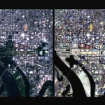
STARPATH GLOBAL highlighted application scenarios including infrastructure monitoring, maritime activity monitoring, environmental change analysis, and emergency response, demonstrating the potential of commercial satellite data for wide-area monitoring, change detection, and rapid situational awareness.

The STARPATH GLOBAL team introduces satellite products and application scenarios
From Satellite Data to Business Value: The FDE Approach
In addition to satellite and data products, STARPATH GLOBAL further introduced its Forward Deployed Engineer (FDE) approach at the expo.
Unlike traditional satellite data services, which primarily focus on imagery procurement and data delivery, the FDE approach starts with the customer’s actual business challenges. Engineering teams work closely with customers to understand their business objectives and workflows, identify high-value scenarios where remote sensing can provide solutions, and develop deployable application solutions. These solutions are then validated in practice to assess their business value and ROI.
At its core, the approach starts with a practical question:
Can satellite technology actually solve this problem and generate sufficient business value?
To lower the initial barriers for customers exploring new technologies, STARPATH GLOBAL has launched the Pioneer Partner Program. Eligible partners may receive an initial opportunity assessment and value-validation process before entering into a broader commercial engagement. This may include high-value use-case identification, solution design, qualifying on-site engineering support, and ROI assessment.
This approach is particularly suited to overseas industry organizations exploring satellite remote sensing, enterprise customers looking to adopt space-based information technologies for the first time, and organizations that have yet to establish mature space data capabilities. Customers often need more than a satellite data supplier; they need a long-term partner that can help identify opportunities, design implementation pathways, and validate the value of investment.
“Many companies do not necessarily lack data. What they really need is to understand which data can solve their problems and what kind of return they can expect from their investment,” said Jing Lv. “Through FDE and the Pioneer Partner Program, we want customers to validate value first and then decide whether to invest. For eligible partners, we are willing to take on the cost of the initial value validation and demonstrate the value of satellite technology through actual results rather than product presentations alone.”
This approach further reinforces STARPATH GLOBAL’s positioning as a geospatial intelligence solutions partner, evolving beyond the role of a satellite data provider.

The STARPATH GLOBAL team discusses satellite remote sensing applications with overseas expo participants
Engaging with International and Industry Partners to Explore Global Applications
During the expo, the STARPATH GLOBAL team engaged with industry representatives, technology companies, and end-user organizations from different countries and regions. Discussions covered local demand for space-based information, data access, application deployment, and potential uses of satellite remote sensing in resource management, infrastructure monitoring, emergency response, unmanned-system coordination, and security-related scenarios.
STARPATH GLOBAL also held further discussions with several industry organizations and exchanged views on potential project cooperation, data testing, and scenario validation. Some partners expressed interest in further technical exchanges and application validation, with follow-up discussions and cooperation set to continue after the expo.

The STARPATH GLOBAL team engages with representatives from relevant industries
Partnering with Industry to Expand the Commercial Space Opportunity
Through its participation in the expo, STARPATH GLOBAL demonstrated how satellite services, multi-source data, intelligent analysis, and industry applications can work together to address real-world operational needs. The company continues to transform space-based information from “data that can be acquired” into “intelligent outputs that can support business decisions.”
Looking ahead, STARPATH GLOBAL will continue to advance commercial space applications in global markets and work with international partners to explore high-value applications of satellite remote sensing across key industries.
STARPATH GLOBAL thanks all guests, industry representatives, and professional visitors who visited its booth and engaged with the team during the expo. The company looks forward to deepening cooperation with industry organizations and partners worldwide and exploring new opportunities for satellite remote sensing and geospatial intelligence applications.

STARPATH GLOBAL at the expo