Commercial operators controlled 270 of the 472 Earth observation satellites identified by the U.S. Geological Survey in 2024, overtaking the 202 spacecraft operated by governments and accelerating a shift toward privately supplied imagery, analytics and geospatial intelligence. An OECD assessment published on February 10, 2026, said advances in sensors, cloud computing and artificial intelligence are expanding access to satellite data while creating new national security, privacy and information-integrity risks.

This synthetic aperture radar image captured by a Capella Space satellite shows a solar farm floating on top of the human-made Lake Tiangang in China. (Image credit: Capella Space)
Earth observation was once dominated by large government spacecraft and long-duration public programs such as Landsat. Lower launch costs, sensor miniaturization and the proliferation of small satellites now allow commercial companies to deploy specialized constellations capable of revisiting locations several times per day.
The improving performance of commercial sensors is also narrowing the gap with government systems. According to the OECD, a U.S. operator released a commercial synthetic aperture radar image with 16-centimeter resolution in 2023, while a commercial sensor designed for 10-centimeter imagery reached orbit in March 2025.
Commercial providers increasingly complement open government datasets rather than simply replacing them. Public missions supply calibrated, long-term records used for climate science and land- and ocean-change monitoring, while private constellations offer higher resolution, faster tasking and more frequent revisits for customers willing to pay.

The U.S. government’s Deep Space Climate Observatory (DSCOVR) satellite captured its first view of the entire sunlit side of Earth from one million miles away on July 6, 2015. (Image credit: NASA)
SAR constellations expand persistent monitoring
Synthetic aperture radar has become one of the most important elements of the commercial market. Unlike optical sensors, SAR spacecraft transmit their own radio-frequency signals and measure the returns from the surface, allowing them to collect imagery at night and through clouds, smoke or dust.
Viktor Stoyanov, chief operating officer of Smart Solutions at UAE-based Space42, said the industry is moving from a small number of large, general-purpose satellites toward constellations of smaller, specialized spacecraft. The change improves revisit rates and gives operators more opportunities to collect imagery under time-sensitive tasking.
Space42 operates the Foresight constellation, a sovereign, dual-use SAR system developed with Finnish satellite manufacturer and operator ICEYE. The system currently consists of five operational satellites, including three launched aboard SpaceX’s Bandwagon-4 rideshare mission from Cape Canaveral Space Force Station in November 2025.
Space42 says the X-band satellites operate from approximately 500 kilometers and can produce imagery with ground resolution as fine as 25 centimeters. The spacecraft are distributed across complementary orbits to improve coverage and revisit performance.
The satellites were manufactured in partnership with ICEYE, while critical integration and testing were completed at Space42’s assembly, integration and testing facility in Abu Dhabi. The facility is intended to localize satellite production and technical expertise while giving the UAE greater control over tasking, data processing and distribution.
Space42 plans to maintain and expand the constellation, with two additional satellites scheduled for launch by 2027. Stoyanov said the relatively short operating lives of low Earth orbit spacecraft can be used as an upgrade cycle, allowing replacements to incorporate improvements in resolution, latency and spacecraft longevity.
That model illustrates how countries can acquire sovereign access without independently developing every element of a satellite architecture. Governments retain control over tasking and sensitive information, while international partnerships provide spacecraft technology, manufacturing knowledge and production scale.

A SkySat Earth-observation satellite operated by the California company Planet spotted the wreckage of a failed launch out of Iran’s Imam Khomeini Space Center on Aug. 29, 2019. (Image credit: Planet Labs, Inc.)
AI shifts value from imagery to intelligence
The growing volume of satellite data has made automated processing essential. A multi-satellite constellation can collect more imagery than human analysts can review within operational timelines, particularly during floods, maritime incidents, military crises or supply-chain disruptions.
AI systems can compare each new observation against historical imagery, detect changes, classify objects and prioritize scenes for human review. This can reduce the time between collection and an operational alert from days to minutes.
Onboard processing could shorten that chain further. Satellites equipped with AI can identify relevant signatures before transmitting data, allowing them to downlink alerts or compressed intelligence products instead of an entire image or hyperspectral data cube. This is particularly valuable where ground-station contact time or communications bandwidth is limited.
Hyperspectral instruments add another layer of information by dividing reflected energy into many narrow wavelength bands. The resulting spectral signatures can help identify materials, vegetation conditions, pollutants or chemical characteristics that may be indistinguishable in conventional imagery. Higher spatial resolution, better compression and faster satellite communications are making those sensors more operationally useful.
NASA and IBM’s open-source Prithvi family demonstrates the growing role of foundation models in Earth science. The models can be adapted for applications including flood mapping, wildfire-burn assessment, crop classification and carbon-cycle analysis. Such systems lower the expertise and computing requirements needed to build specialized geospatial applications, although their outputs still require validation against physical measurements and reliable reference data.
A hybrid government-commercial architecture
Commercial imagery is also becoming embedded in national security operations. The U.S. Space Force’s Tactical Surveillance, Reconnaissance and Tracking program uses a marketplace model through which commercial vendors receive short-duration tasking and deliver imagery-derived analytical products to combatant commands.
The National Geospatial-Intelligence Agency and Space Force formalized cooperation on TacSRT in 2025. The program is designed to supply unclassified commercial sensing and analytics when operational users require information that cannot be delivered quickly enough through existing national systems.
This hybrid architecture allows governments to combine sovereign and classified assets with commercial optical, radar, radio-frequency and analytical services. Commercial suppliers contribute capacity and rapid innovation, but their involvement also complicates questions about data ownership, licensing, security and availability during crises.

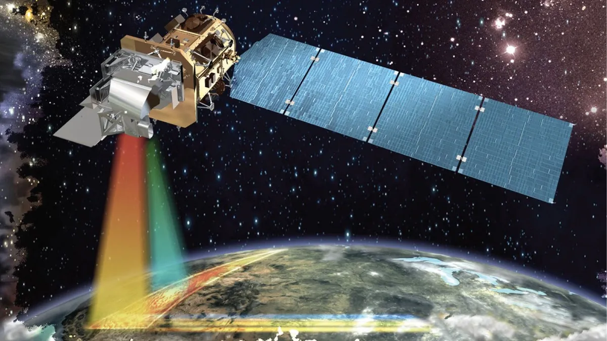
Artist’s illustration of Planet’s Pelican-2 Earth-observing satellite in orbit. (Image credit: Planet Labs PBC)
Regulation trails commercial capability
The dual-use nature of remote sensing is central to the policy challenge. A satellite used to monitor illegal fishing, deforestation or disaster damage may also reveal troop movements, air-defense positions or activity around critical infrastructure.
The OECD found that only a small group of member countries—including Canada, France, Germany, Japan and the United States—had explicit regulations for private Earth observation data in 2024. Those systems commonly regulate data distribution according to spatial, temporal or spectral performance and national security concerns.
More capable imagery can also expose sensitive information about refugee camps, vulnerable communities, private property and patterns of human activity. Although satellites are generally less efficient than terrestrial systems for tracking individuals, combining imagery with location records, communications data and other sources can increase its sensitivity.
AI introduces additional risks because analytical results may be difficult to explain or validate. Poor reference datasets, calibration errors or inappropriate model training can produce confident but incorrect conclusions.
Manipulated or misrepresented satellite imagery poses a separate threat. Synthetic images can exaggerate military damage or fabricate events, while authentic imagery can be presented without the geographic, temporal or sensor context needed for proper interpretation. Vulnerable data links may also permit spoofing or malicious alteration within the collection and distribution chain.
The regulatory task is therefore to protect national interests, privacy and data integrity without restricting the commercial innovation that is improving disaster response, environmental monitoring and economic intelligence. As sensor resolution, revisit rates and onboard processing continue to advance, verification standards and adaptive licensing systems will need to develop alongside the spacecraft themselves.