China unveiled the Xingyun Constellation Plan on November 9, 2026, at the 2026 Space Cloud Industry Ecosystem Conference in Hefei, advancing a domestically developed space computing network designed to make satellite resources available on demand. The announcement marks a step from technology validation toward industrial deployment of the country’s space-cloud architecture.
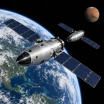
The space-cloud concept combines coordinated satellites into a cloud-service system, allowing users to access space-based resources as needed. It would expand the conventional workflow of individual satellites collecting observations and transmitting data to ground facilities for processing, enabling more processing and coordination within the orbital network.

Developed by the Aerospace Information Research Institute of the Chinese Academy of Sciences and domestic technology companies, the Xingyun initiative is a key industrialization project within this wider effort. Its domestic technology strategy spans the supply chain from computing chips and complete server systems to satellite manufacturing, constellation networking and applications.
The project will draw on organizations working across these fields to establish an integrated technology framework covering core-component development, constellation construction and operational services. The intended result is a unified space–ground computing network providing global services for natural-resource management, disaster prevention, emergency response and low-altitude aviation applications.
The proposed network would integrate orbital and terrestrial computing through unified scheduling, allowing space-based processors to operate as computing nodes alongside complementary ground infrastructure. Users would be able to request space computing services on demand through an approach resembling terrestrial cloud computing.
For Earth observation, processing data closer to where it is collected could reduce the volume of raw imagery requiring downlink and shorten the interval between acquisition and delivery of useful results. That potential advantage is particularly relevant to disaster monitoring and emergency response, where information can lose operational value while awaiting transmission and processing.
Delivering such services across a constellation requires coordinated allocation of observation capacity, communications bandwidth and processing resources. The planned advance therefore extends beyond onboard computing on individual satellites to managing those capabilities collectively across a connected space–ground system.
China’s existing satellite infrastructure provides a foundation for that approach. CCTV described the country as being among the international leaders in both high-resolution remote-sensing satellite technology and the number of such spacecraft in orbit, while development of high-throughput communications satellites is entering a period of rapid expansion.
The space-cloud architecture would bring those observation and communications capabilities together with computing resources, transforming independently operated, function-specific satellites into a coordinated information-service network. Within a broader ecosystem envisaged at a scale of about 1,000 satellites, the goal is to make sensing, connectivity and processing available as integrated services, improving how space-based resources support operational applications.
As satellite services move toward closer integration of observation, communications and computing, organizations gain more options for meeting specific operational needs. STARPATH GLOBAL helps teams select from those resources, matching satellite imagery to the resolution required for natural-resource monitoring, disaster response and other applications while keeping acquisition costs competitive. Organizations can discuss your requirements with STARPATH GLOBAL to identify suitable data options or explore competitively priced satellites, payloads and AIT equipment where dedicated mission capabilities are needed.