A satellite may be able to revisit your site every few days, yet the interval between usable images can be much longer. Clouds, acquisition schedules, viewing conditions and delivery requirements all affect when a new observation becomes useful. For monitoring projects, the key question is not simply how often a satellite can see the target, but how often it can deliver evidence that supports your decision.
Understanding this difference helps avoid a common planning mistake: treating a published revisit interval as a guaranteed monitoring schedule.
Four Different Clocks Behind a Monitoring Service
Satellite monitoring involves several distinct measures of time:
- Revisit interval: the time between opportunities to observe a location under specified orbital and viewing conditions.
- Acquisition interval: the time between images actually collected over the target.
- Usable observation interval: the time between collected images that meet the task’s coverage, visibility, resolution and quality requirements.
- Delivery latency: the time from acquisition to the availability of an image or analytical result.
A dashboard’s update schedule is another separate measure. A platform can refresh every day while displaying an image acquired several days earlier. A useful monitoring interface should therefore show the acquisition date, the processing or delivery date, and any quality limitations.
Orbit Time Is Not Revisit Time
A satellite completing an orbit does not immediately return to the same target. Earth rotates beneath it, shifting the ground track of successive passes. The opportunities to observe a location depend on the orbit, sensor swath, latitude, pointing capability and number of satellites available.
Landsat provides a clear example. Landsat 8 and Landsat 9 each circle Earth approximately every 99 minutes, but each has a 16-day repeat cycle over the same location. Their offset orbits provide an eight-day combined repeat interval. None of these figures guarantees a cloud-free image every eight days.
Sentinel-2’s nominal two-satellite configuration provides a five-day revisit under the same viewing conditions across its regular coverage areas. Swath overlap and additional acquisitions can increase observation opportunities in some locations. The appropriate interval for a project should still be checked against the actual area of interest and acquisition plan.
Agile commercial satellites can also look away from their ground tracks, creating opportunities before the orbit repeats exactly. However, more access opportunities do not automatically mean more comparable images: changes in viewing angle can affect image geometry and the visibility of features.
Why Some Acquisitions Do Not Become Usable Observations
Cloud Cover Must Be Assessed Over the Target
For optical imagery, cloud and cloud shadow can obscure the features being monitored. Haze, snow and poor illumination may also reduce usefulness.
The cloud percentage reported for an entire scene is only a screening tool. A scene with relatively little cloud can still have your mine, farm or construction site completely obscured. Conversely, a cloudy scene may contain a clear view of the specific target.
Monitoring requirements should therefore define acceptable visibility within the area of interest. Seasonal conditions matter as well: observations may arrive regularly during a dry season and become much less frequent during a persistent wet season.
An Available Pass May Not Be Scheduled for Imaging
Systematic missions collect imagery according to established observation plans. Commercial tasking adds further considerations, including competing orders, task priority, imaging mode, collection capacity and the size of the requested area.
A small site and an extensive corridor can therefore have different collection prospects, even when both are accessible to the same constellation. A large area may require several acquisitions, and those acquisitions may occur on different dates.
The Image Must Match the Measurement
An image can be clear and still be unsuitable for a particular task. Its resolution may not reveal the required feature, its spectral bands may not support the analysis, or its viewing geometry may make comparison with earlier imagery difficult.
For construction monitoring, steep viewing angles can hide ground features behind buildings. For vegetation analysis, differences in illumination, atmosphere and sensor characteristics can influence the measured signal. These effects must be considered before interpreting an apparent change as a real change on the ground.
Does SAR Solve the Frequency Problem?
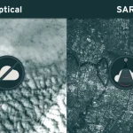
Synthetic aperture radar, or SAR, can observe through cloud and operate without daylight. It can substantially improve monitoring continuity where optical observations are frequently obstructed.
However, SAR does not remove acquisition scheduling, coverage or delivery constraints. Its usefulness also depends on the application. Radar responds to surface structure, moisture and viewing geometry, so a SAR image cannot automatically replace an optical image in an existing workflow.
For radar time series, parameters such as orbit direction, incidence angle and polarization may need to remain consistent. Interferometric deformation monitoring requires suitable repeat acquisitions and sufficient coherence, rather than simply the largest possible number of radar images.
Fast Delivery Starts After Collection
Once a satellite acquires an image, the data must be downlinked, processed, checked and distributed. An analytical service may then require additional steps, such as cloud masking, image alignment, change detection and review.
This means that a short delivery commitment measured from acquisition is different from a short turnaround measured from the customer’s request. A provider might deliver quickly after collection while still needing time to secure a suitable imaging opportunity.
For urgent requests, establish three separate milestones: the collection window, the image delivery deadline and the deadline for the required analytical result. Confirm which products and processing steps each commitment includes.
Plan the Frequency Around the Decision
The following approaches are planning starting points, rather than guaranteed service intervals. Each should be adjusted to the target, season, required detail and consequences of a missed observation.
Build a Time Series That Shows Its Gaps
Combining satellites can increase observation opportunities. NASA’s Harmonized Landsat and Sentinel-2 project, for example, brings observations from both missions into a common 30-meter surface reflectance framework. This improves temporal sampling, but cloud screening still determines which observations are usable at a particular location.
Simply stacking images from different sensors is not enough. A dependable time series requires appropriate alignment, quality masking and treatment of differences in resolution and spectral response.
Composites and interpolation also need clear labels. A monthly cloud-free mosaic may combine pixels acquired on different dates. An interpolated value estimates conditions between observations; it is not a new satellite measurement.
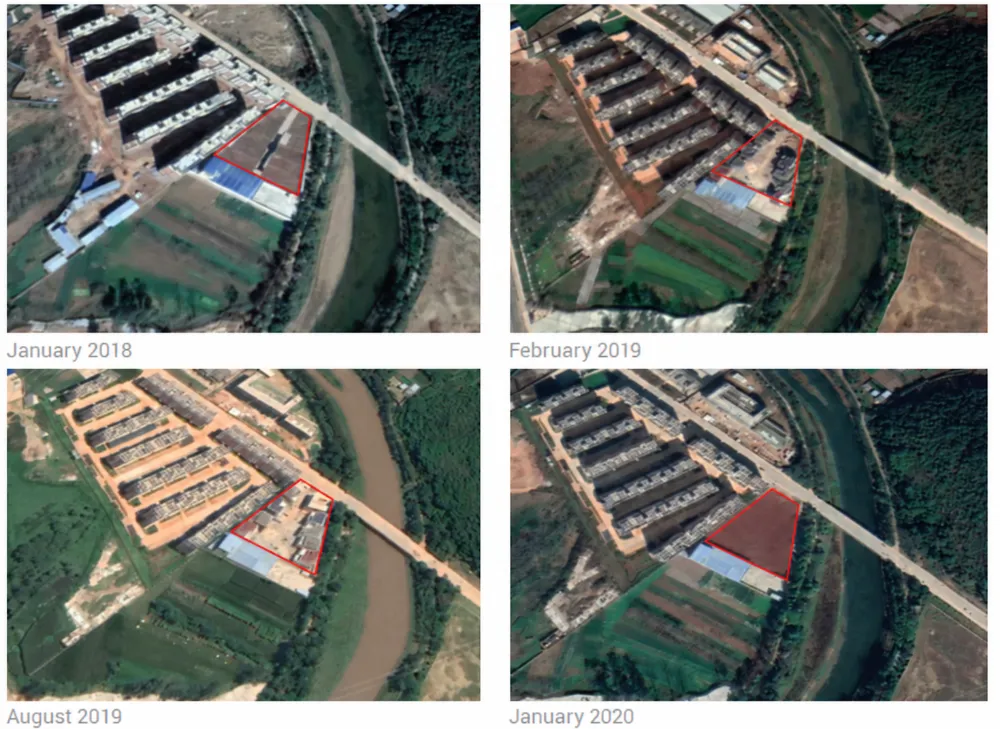
For change detection, gaps affect what can be concluded. If a site is unchanged in one usable image and disturbed in the next, the evidence places the change between those acquisition dates. It does not establish the exact day the activity began.
What to Specify Before Ordering
A practical monitoring brief should define the area of interest, target features, minimum resolution, acceptable cloud and shadow over the target, viewing constraints, collection windows and delivery deadlines. It should also state the maximum acceptable gap between usable observations and what should happen if that gap is exceeded.
Review historical imagery for the same location and season where possible. Assess both typical gaps and prolonged outages: a favorable annual average can conceal a long interruption during the period that matters most.
For an urgent request, flexibility can improve feasibility. A wider collection window, an alternative sensor or adjusted viewing constraints may create more options, provided the resulting image still supports the intended decision.
STARPATH GLOBAL helps customers match imagery selection to the detail, timing and budget their monitoring task requires. Explore our satellite imagery catalog to compare data options, or share your target area and deadline with our team for archive screening and a tasking feasibility assessment. For time-sensitive projects, we can help assess available collection and delivery options so that the response plan reflects actual conditions.